– The Netherlands, Delta Program Regions
Sea Level Rise 2100
Research-by-design exploring the spatial impact of accelerated sea level rise.
Assignment
Recent scenarios show that the sea level might rise faster during the course of the 21st century than considered in the Delta scenarios that are currently used by the Delta Programme. It is unsure yet if this is really going to happen, but these scenarios do raise a lot of questions: What does this mean for the Netherlands? Which functions will be under pressure and which opportunities will arise?
Assigned by the Ministry of Internal Affairs and the Delta Programme Commissioner, we are working on the “Spatial design exploration on the consequences of accelerated sea level rise”. Based on a “what if” approach we explore possible spatial impacts of accelerated sea level rise, varying between 1 meter to a maximum of 3 meters in 2100. This is the range of accelerated sea level rise as it is used by Deltares in the report “Mogelijke gevolgen van versnelde zeespiegelstijging” (Possible impacts of accelerated sea level rise) and is based on the scenarios of the KNMI (Royal Netherlands Meteorological Institute), in which the accelerated breaking off and melting of Antarctica is included.
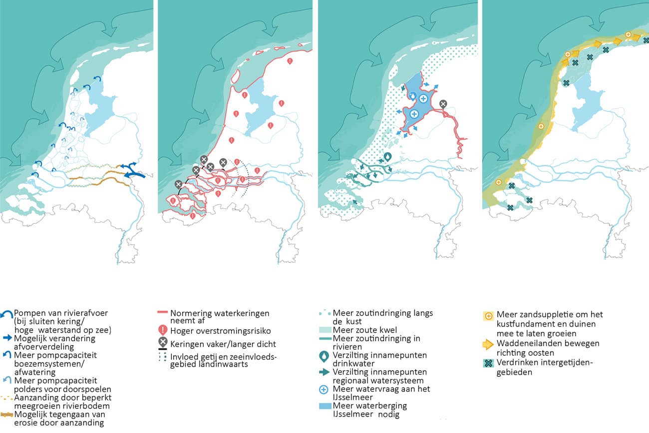
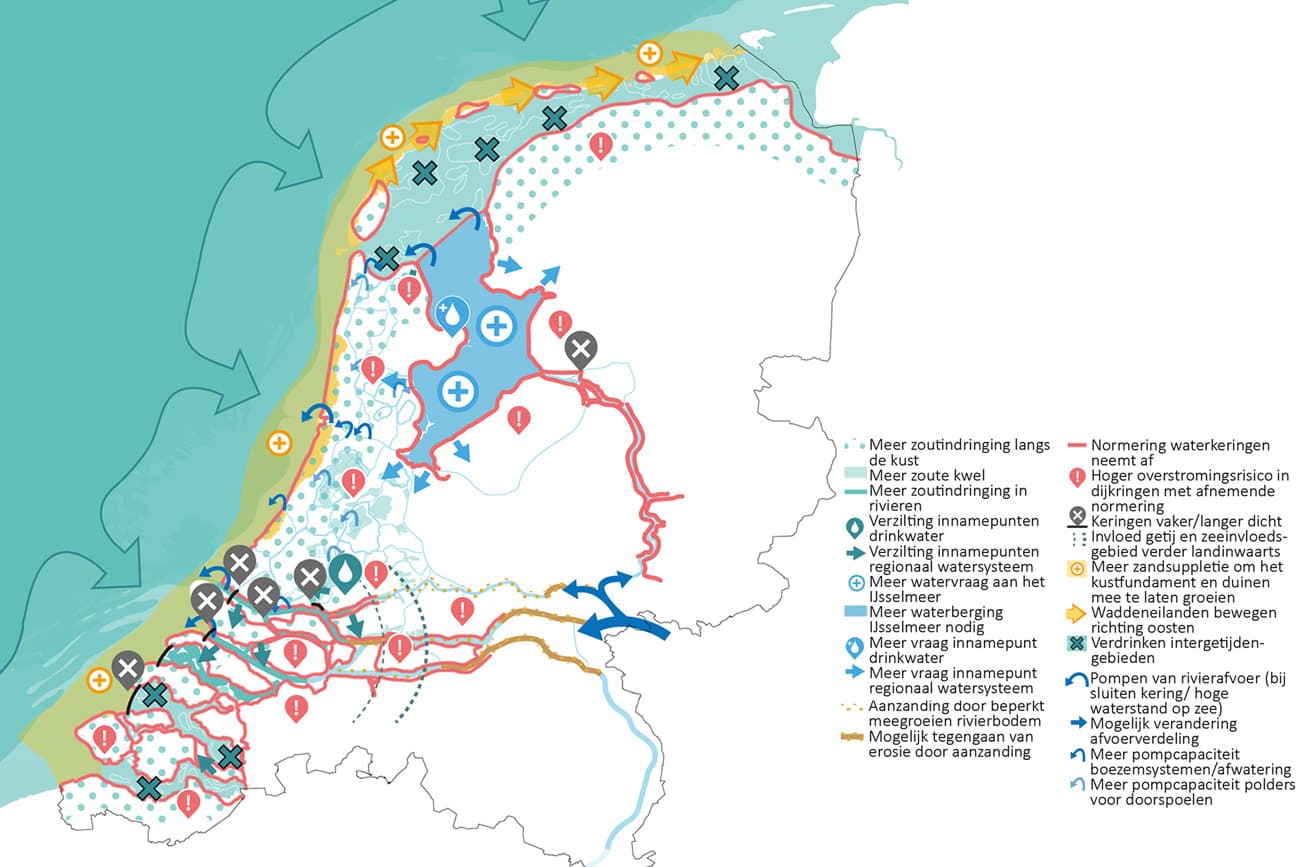
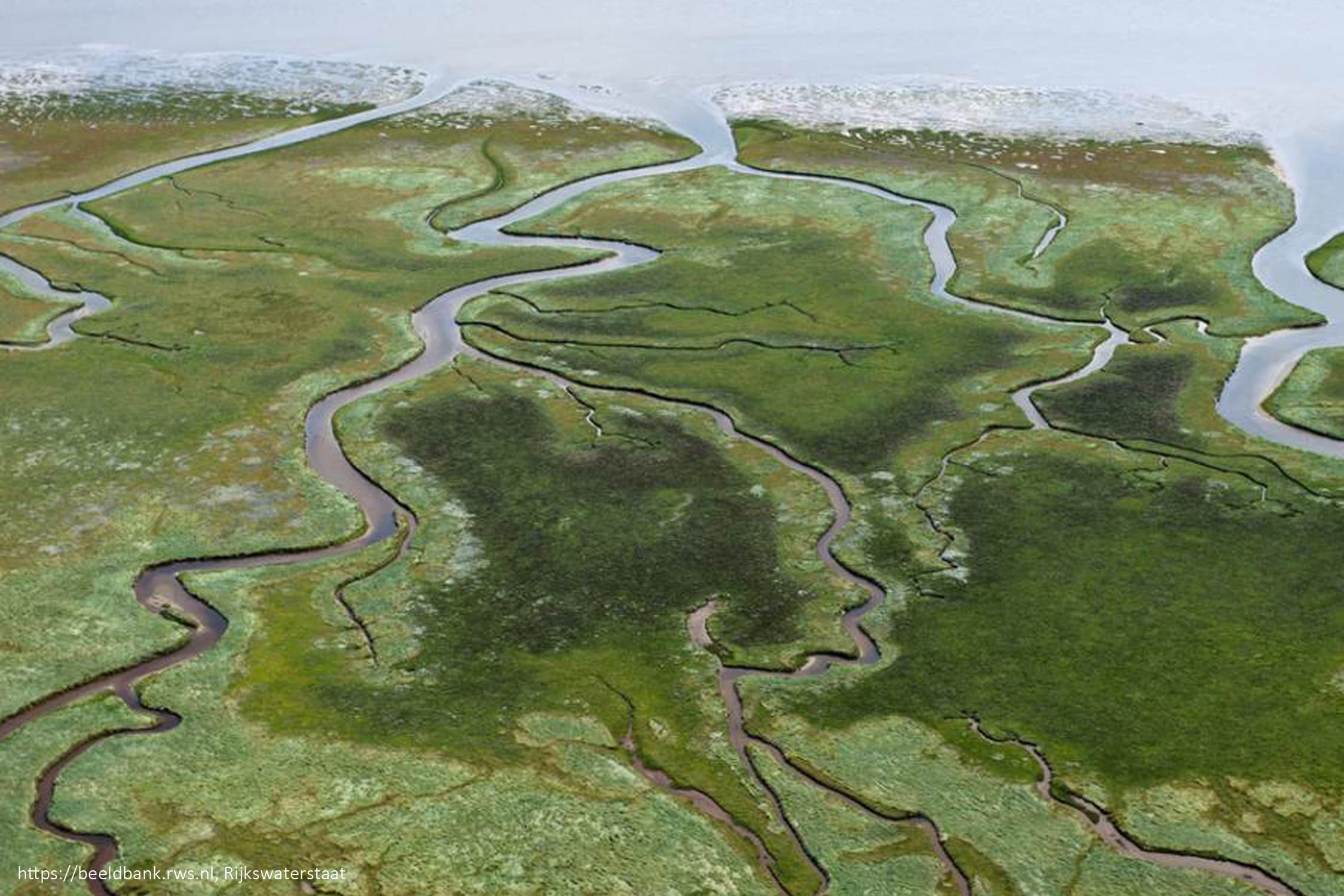
This spatial exploration aims to gain insight in the relations between sea level rise and expected spatial-economic developments, based on the system relations between sea level rise and the current water system (flood risk, water availability, stormwater management and the coastline).
Approach
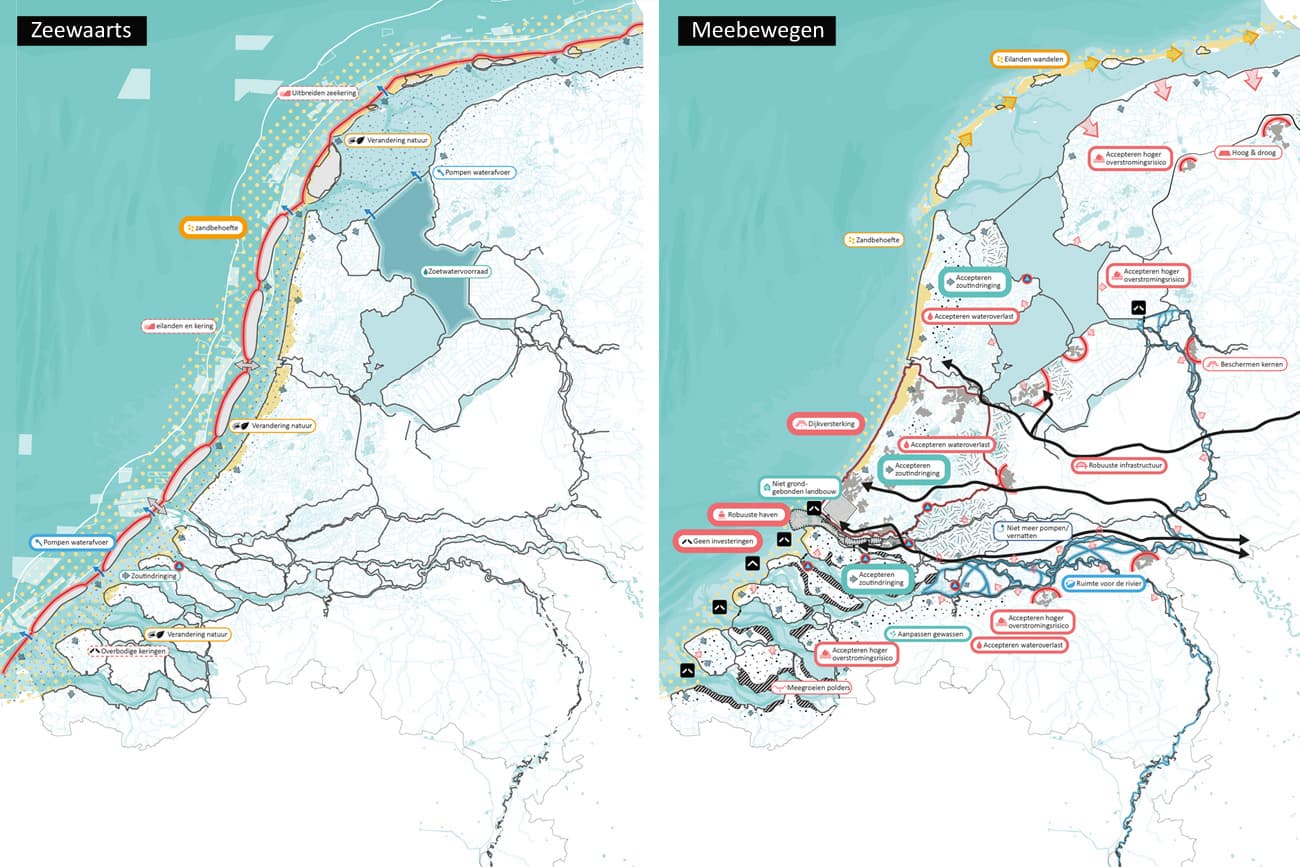
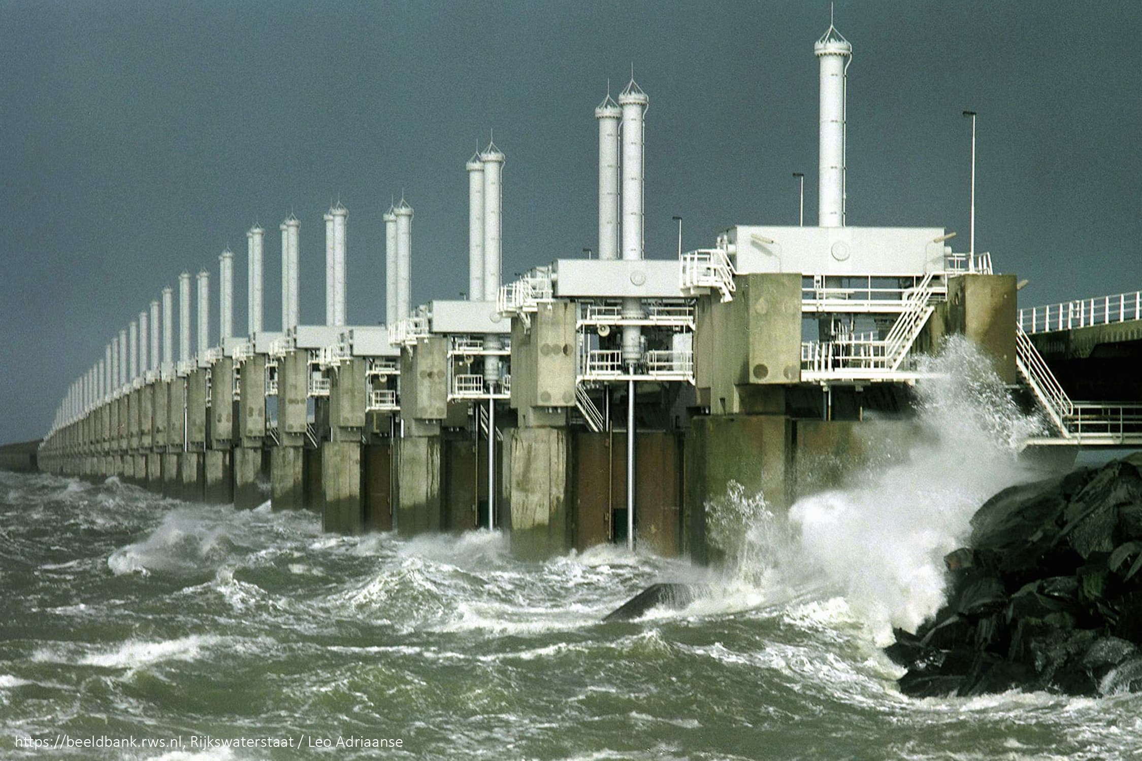
Based on the insight of the system relations, the relations between sea level rise, the water system and spatial-economic developments are explored via a research-by-design approach. Thereby, possible attention points and opportunities are made clear, that can be relevant for future decisions on policy making and investments. The four by Deltares defined cornerstones for possible adaptation strategies (protection, accommodation, coastal advance, and strategic retreat) are used as starting point in this “what if” exercise. Using design research to explore: “What if we follow this adaptation strategy?”, insights of relations with effects on other assignments are generated. Specifically looked at are the relations with assignments and transitions in the field of urbanization, energy transition, ecology, economy, agriculture, and mobility.
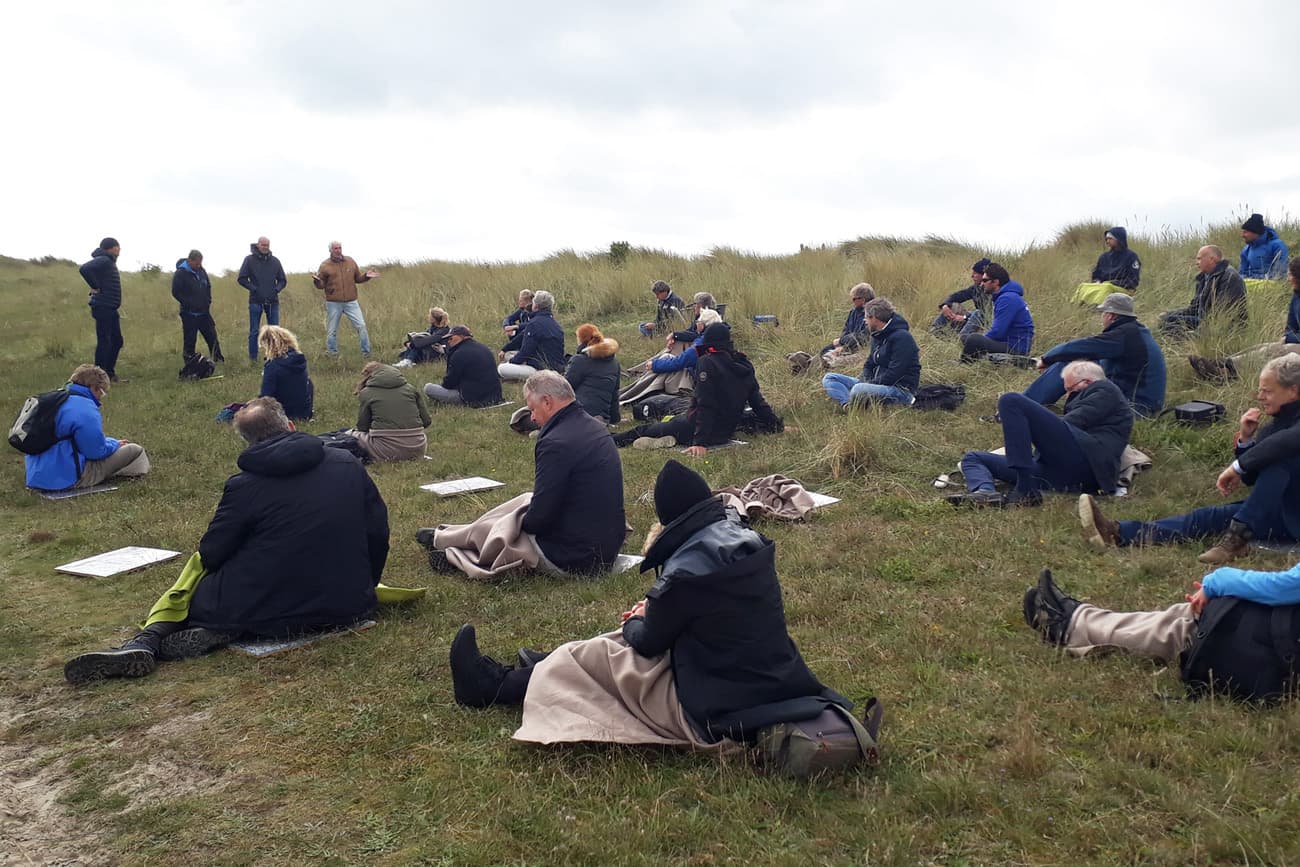
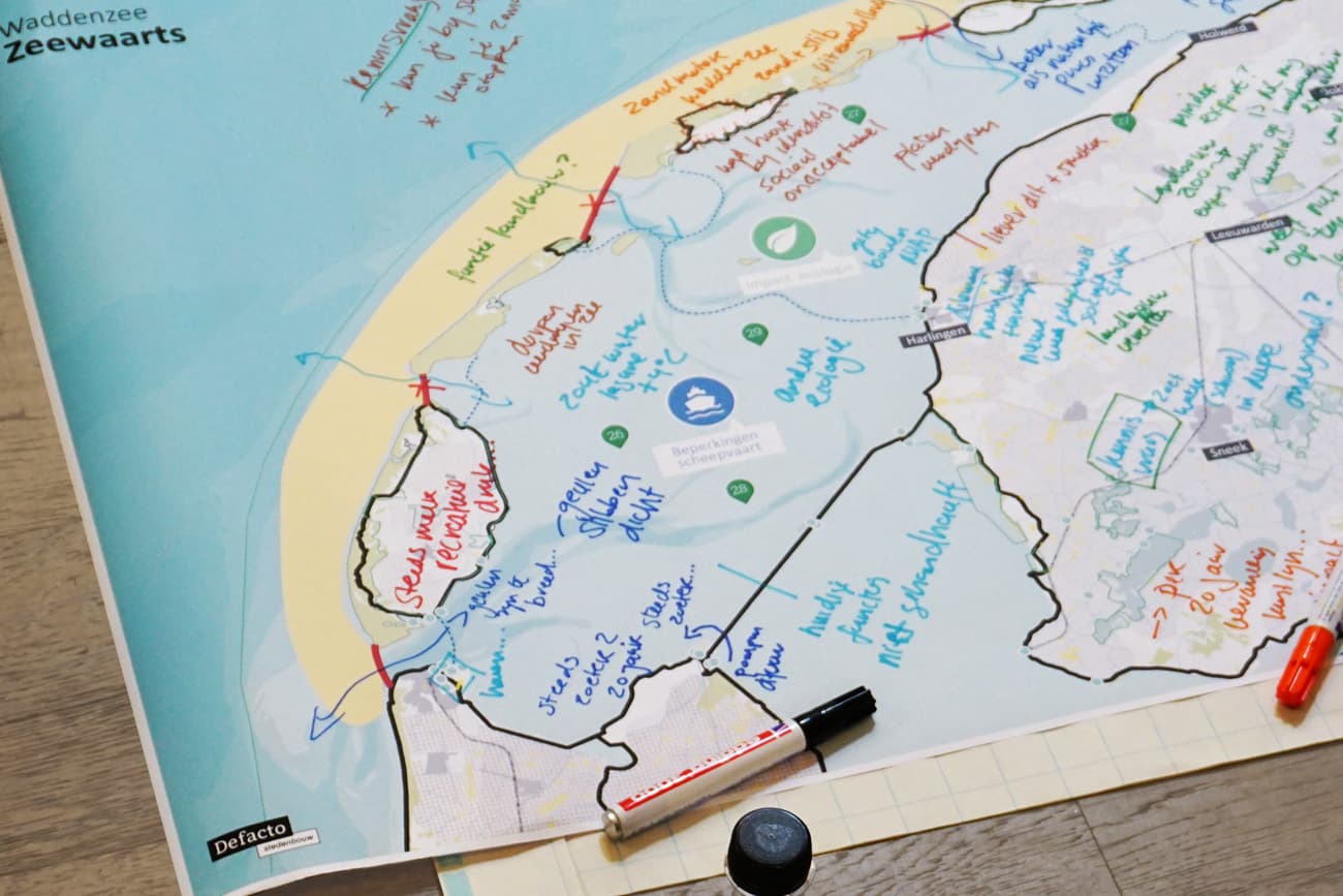
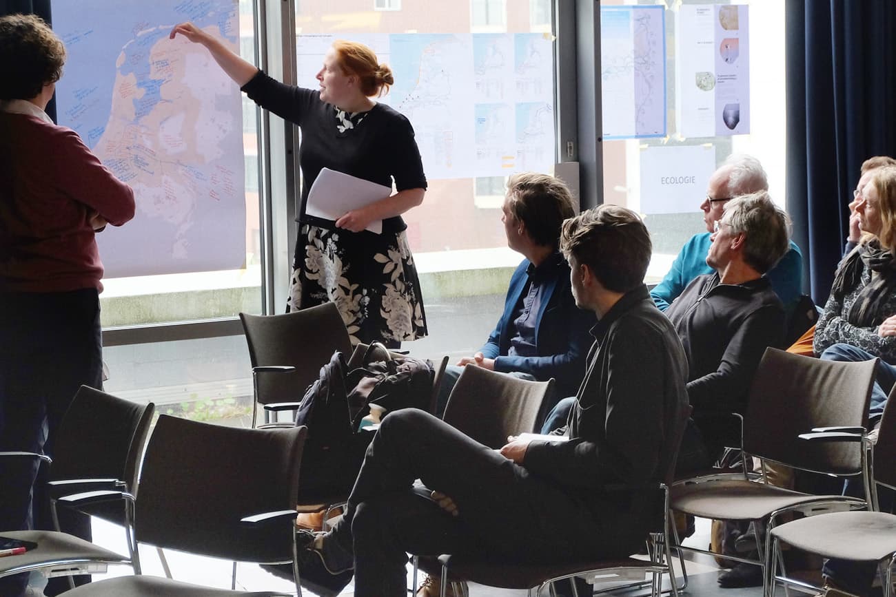
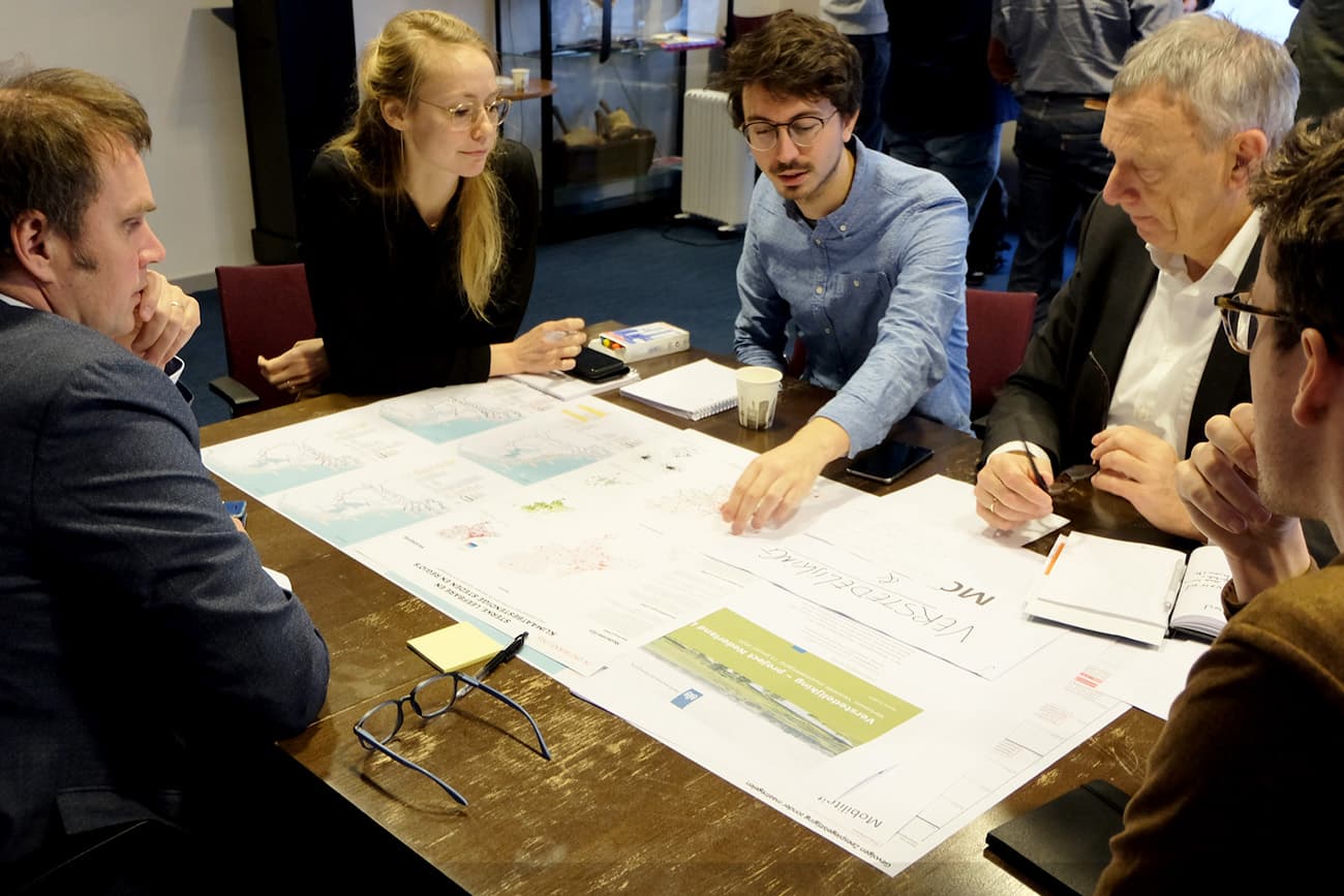
Based on area specific workshops, the research by design exploration on the national scale and the identified relations with other assignments and transitions will be supplemented with insights and relations between (adaptation strategies for) accelerated sea level rise and area specific spatial-economic assignments. The area workshops will give insight into important opportunities, dilemmas, and knowledge questions for the preferred strategies for the different areas.
Client
Ministry of Internal Affairs (BZK/Atelier X), Delta Programme Commissioner, Ministry of Infrastructure and Water Management
Opgave
Recente scenario’s laten zien dat de zeespiegel in de loop van de 21e eeuw mogelijk sneller stijgt dan in de momenteel door het Deltaprogramma gehanteerde Deltascenario’s. Of dit daadwerkelijk het geval zal zijn is nog onzeker, maar deze scenario’s roepen wel veel vragen op: Wat betekent dit voor Nederland? Welke functies komen hierdoor onder druk te staan en welke kansen brengt dit met zich mee?
In opdracht van het Ministerie van BZK en de staf Deltacommissaris werken we aan de ‘Ruimtelijke ontwerp verkenning gevolgen versnelde Zeespiegelstijging”. Middels een “what if” aanpak verkennen we de mogelijke ruimtelijke impact van een versnelde zeespiegelstijging, variërend van 1 meter tot maximaal 3 meter in 2100. Dit is de range voor versnelde zeespiegelstijging zoals door Deltares gehanteerd in het rapport “Mogelijke gevolgen van versnelde zeespiegelstijging” en is gebaseerd op scenario’s van het KNMI waarin het versneld afbreken en afsmelten van Antarctica is meegenomen.
Het doel van deze ruimtelijke verkenning is om op basis van systeemrelaties tussen zeespiegelstijging en het huidige watersysteem (waterveiligheid, waterbeschikbaarheid, wateroverlast en het kustfundament), inzicht te krijgen in relaties tussen zeespiegelstijging en de verwachte ruimtelijk-economische ontwikkelingen.
Aanpak
Door middel van inzicht in systeemverbanden wordt ontwerpend de relatie tussen zeespiegelstijging, het watersysteem en ruimtelijk-economische ontwikkelingen verkend. Daarbij worden mogelijke aandachtspunten en kansen inzichtelijk gemaakt, die relevant kunnen zijn voor toekomstige beleids- of investeringskeuzes. De vier door Deltares benoemde oplossingsrichtingen (zijnde beschermen gesloten, beschermen open, zeewaarts en meebewegen) worden bij deze ‘what if’ oefening als uitgangspunt gebruikt. Door ontwerpend te verkennen; ‘Wat als we deze oplossingsrichting volgen?’ ontstaat er inzicht in de relaties met en effecten op andere opgaven. Daarbij wordt specifiek gekeken naar relaties met opgaven en transities op het gebied van verstedelijking, de energietransitie, ecologie, economie, landbouw en mobiliteit.
De ontwerpverkenningen op nationale schaal en de geïdentificeerde relaties met andere opgaven en transities zullen op basis van gebiedssessies aangevuld worden met inzichten in relaties tussen (oplossingsrichtingen voor) versnelde zeespiegelstijging en gebiedsspecifieke ruimtelijk economische ontwikkelopgaven. De gebiedsessies zullen inzichten geven in belangrijke kansen, dilemma’s en kennisvragen voor de voorkeursstrategie voor de deelgebieden.
Opdrachtgever
Ministerie Binnenlandse Zaken (BZK/Atelier X), Staf Deltacommissaris, Ministerie IenW