Utrecht, the Netherlands
Climate-adaptive Utrecht
Guideline for suitability map of residential and work locations
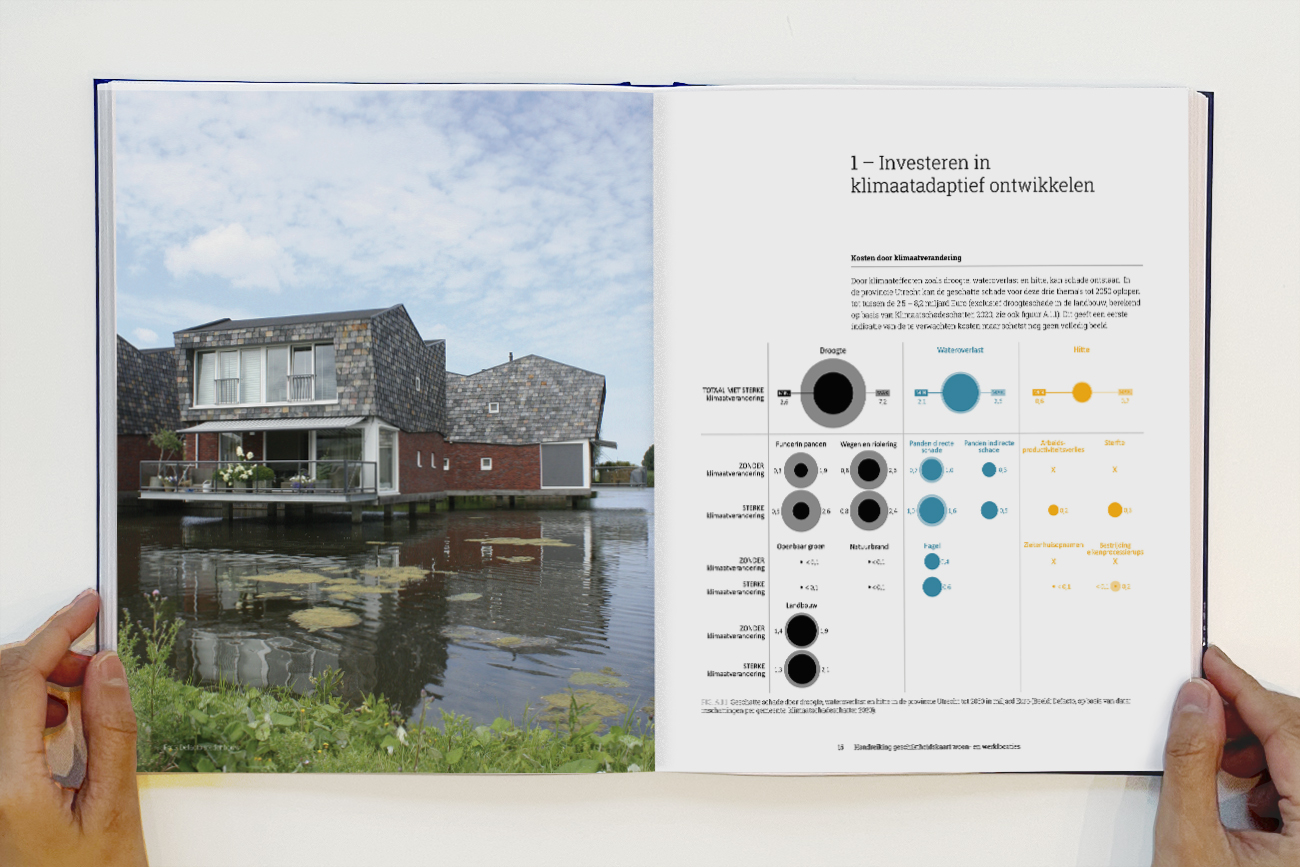
The Province of Utrecht faces a major challenge in the coming years, such as creating new residential and business locations that are also future-proof in the long term. In collaboration with the Utrecht Water Partners, the Guideline Suitability Map for Residential and Business Locations has been developed. This guideline provides concrete support for assessing the suitability of locations, with an emphasis on water, soil, and climate change.
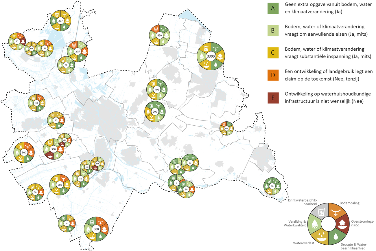
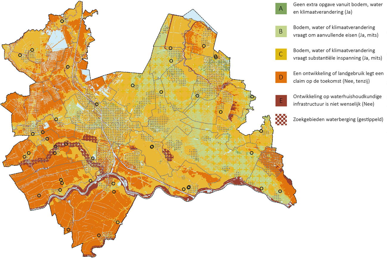
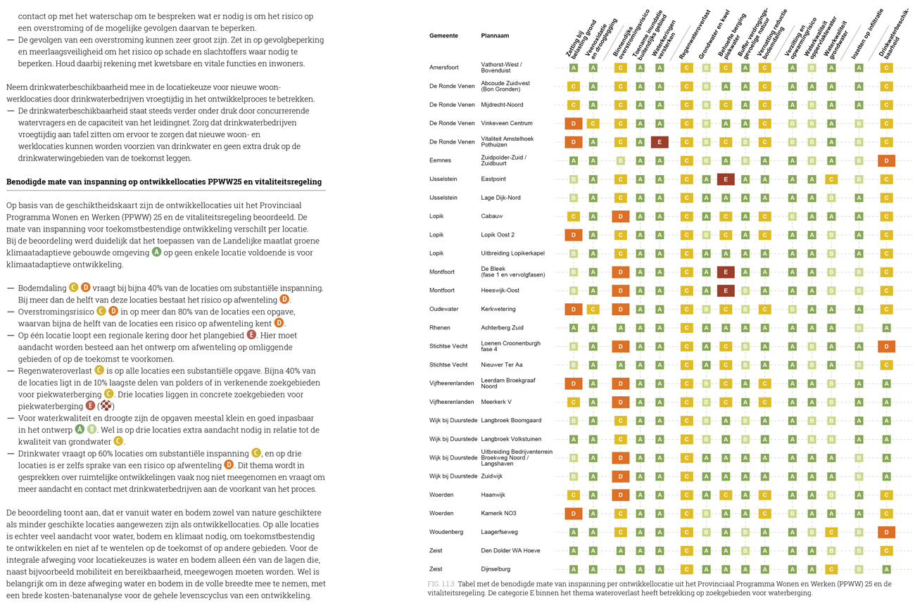
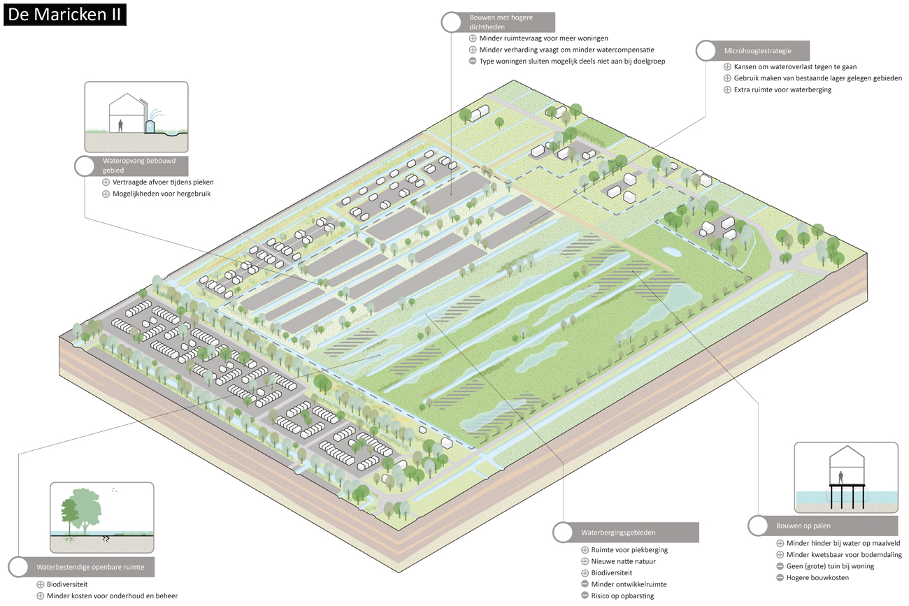
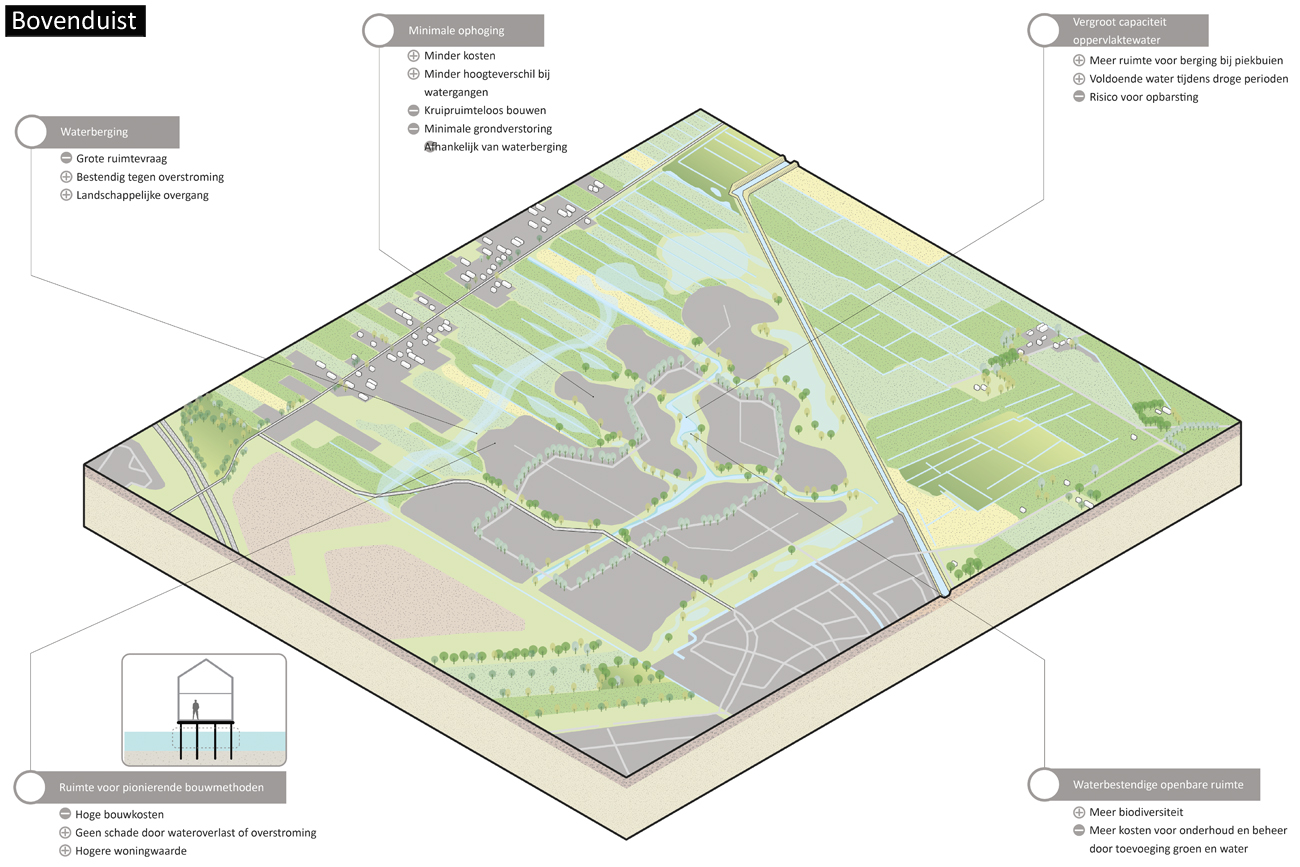
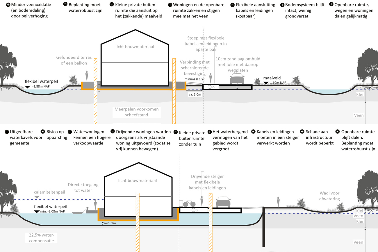
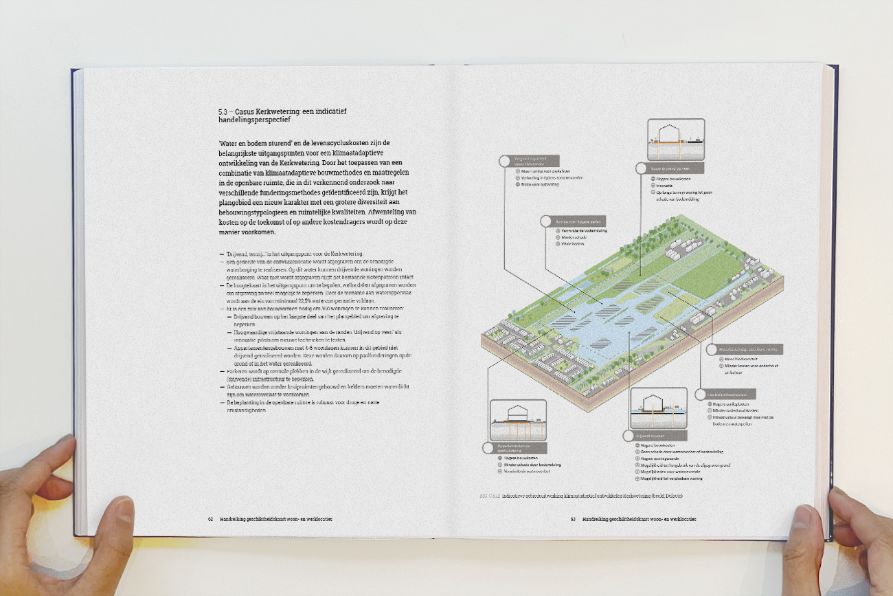
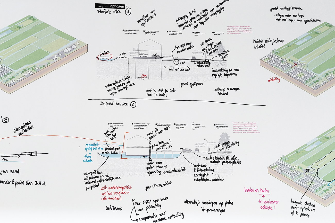
At the core of the document are a decision tree—which helps in making well-founded choices in the spatial development process—and a toolbox with practical approaches for climate-adaptive construction. Additionally, four case study areas were examined: Kerkwetering, Bovenduist, De Maricken II, and Meerkerk V. These case studies demonstrate how the suitability map functions across different types of areas and what measures are appropriate in each situation, based on the principle of water and soil as guiding factors.
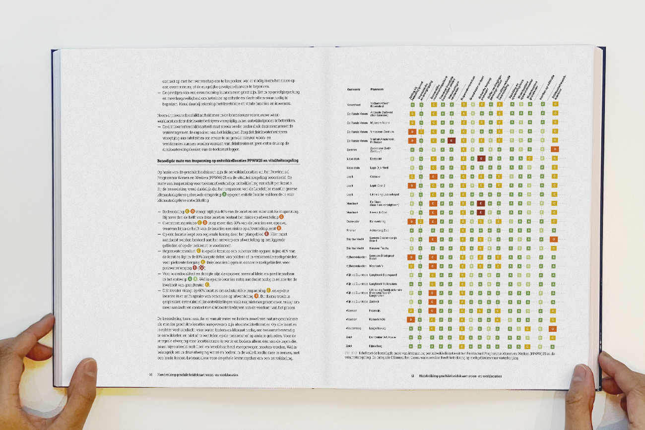
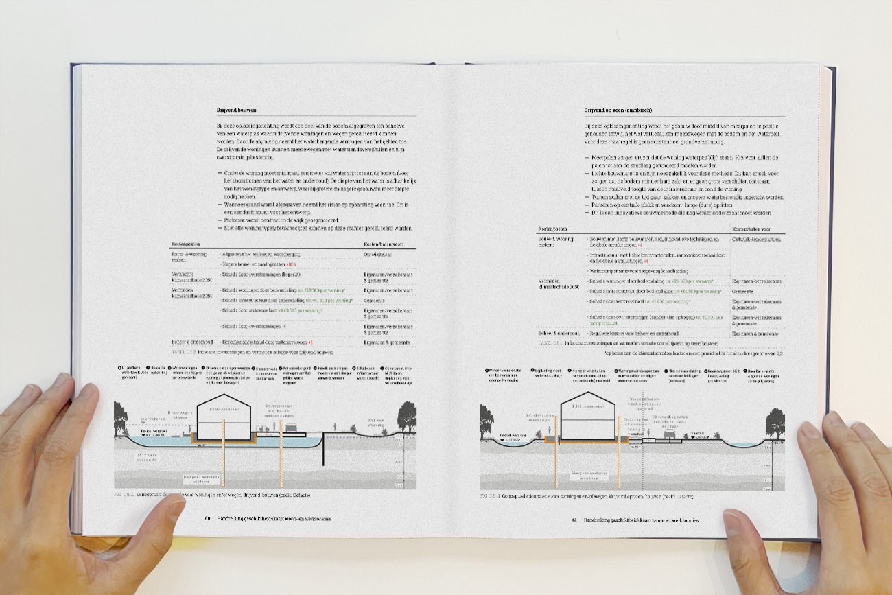
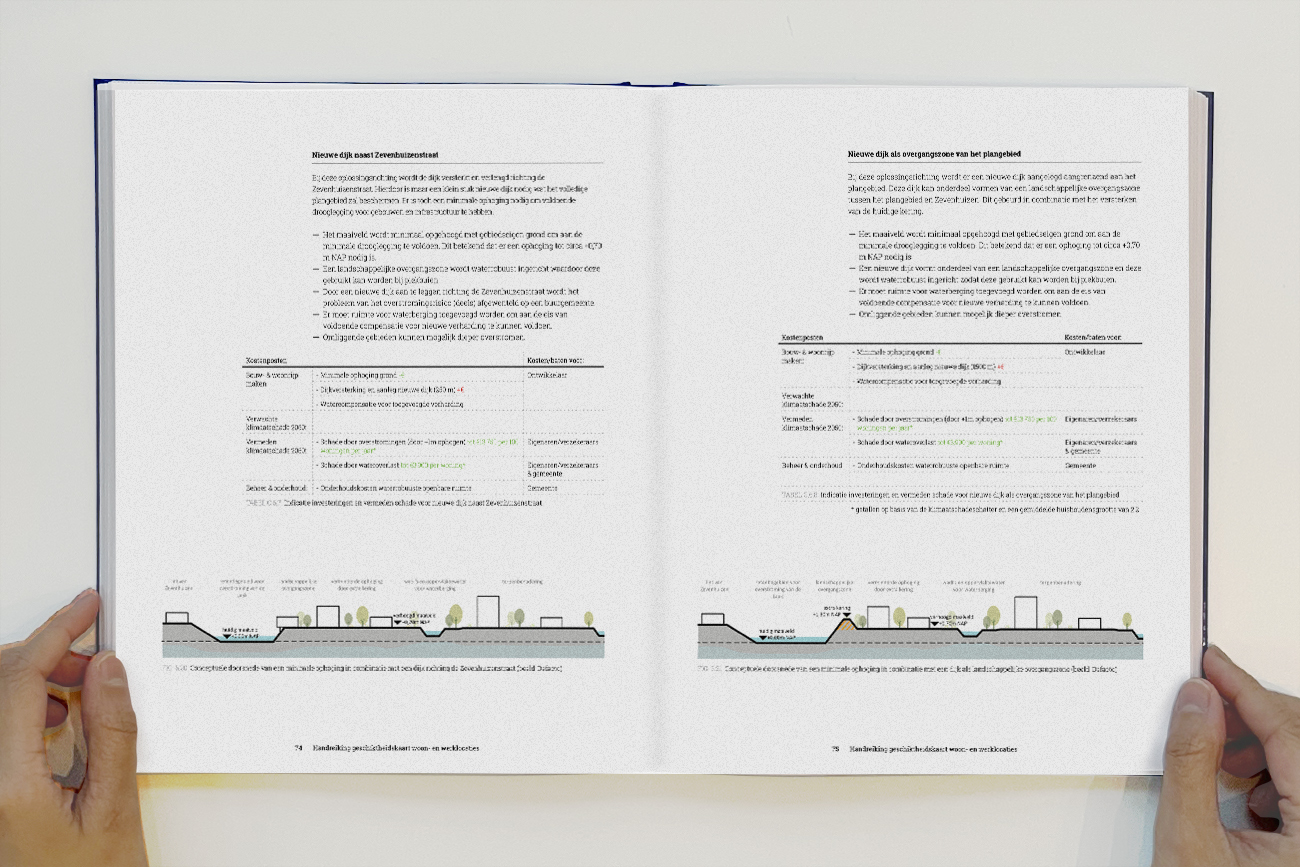
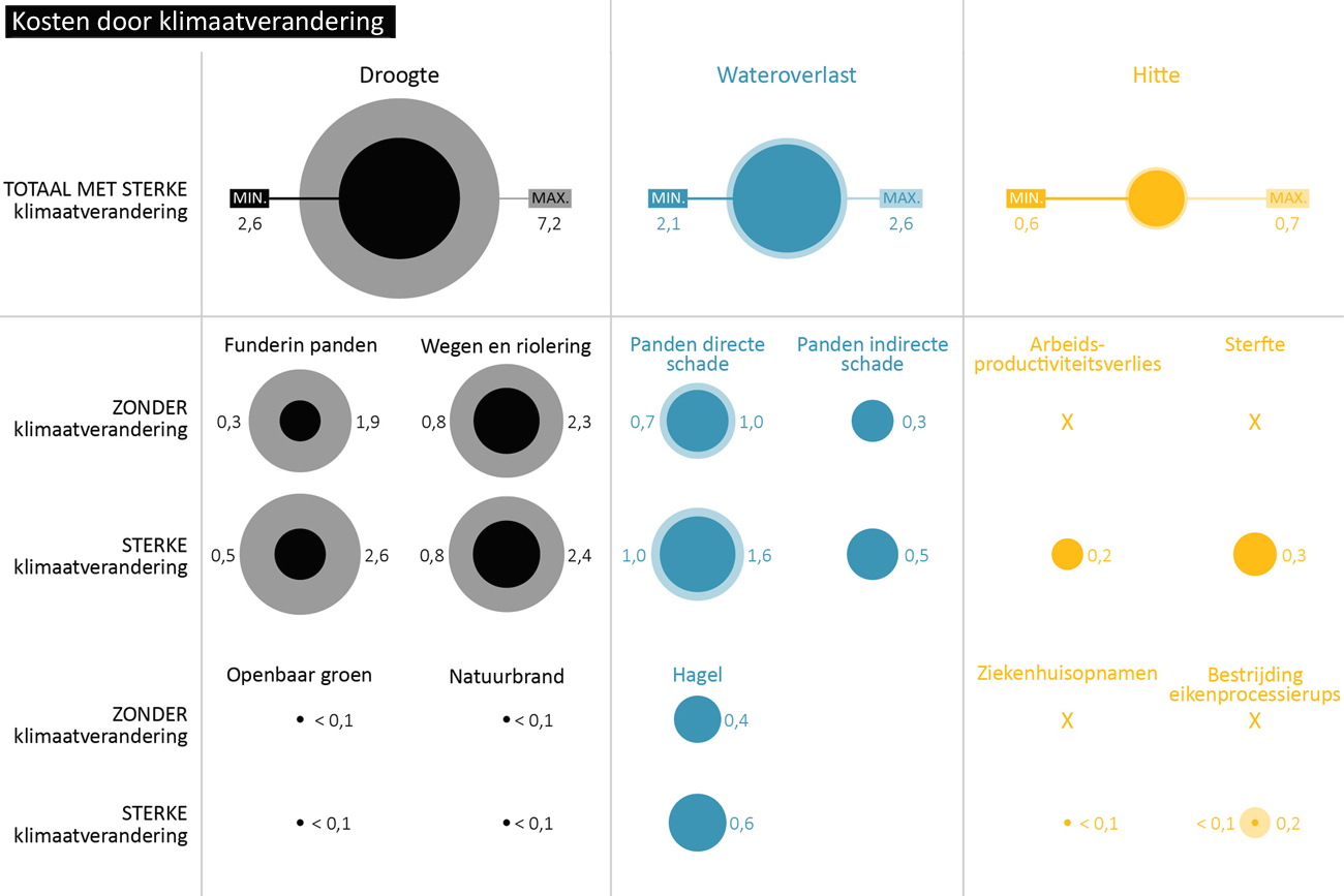
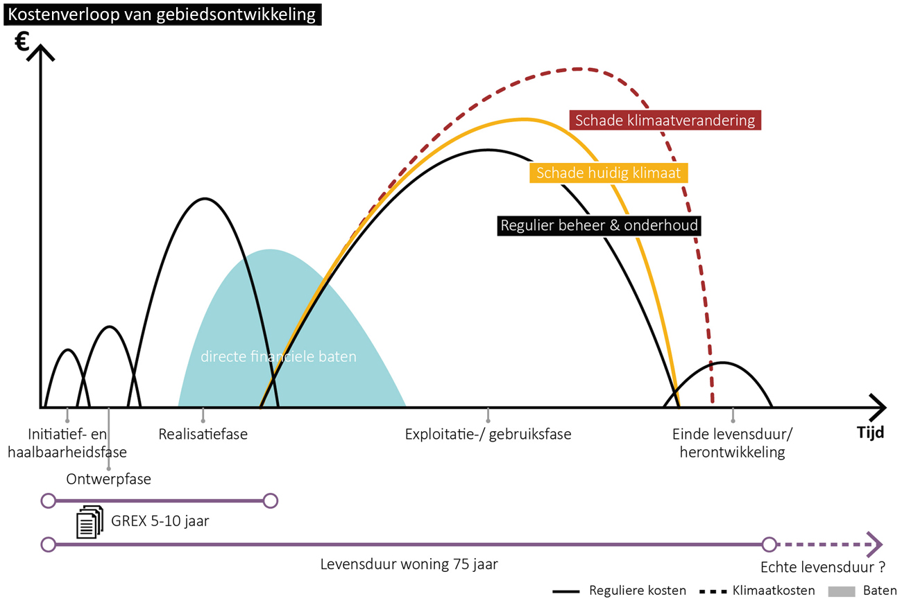
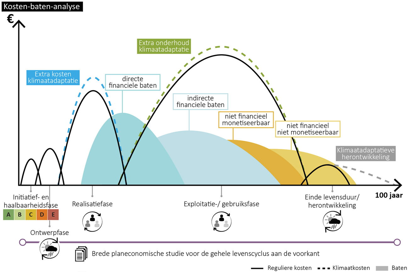
The case studies show that none of the examined locations meet the National Standard for a Green Climate-Adaptive Built Environment without additional measures. In many cases, substantial interventions are needed, for example, to reduce soil subsidence or prevent waterlogging. The results highlight the importance of an area-specific approach and the early integration of climate-adaptive measures in the development process.
This guideline thus offers not only policy frameworks but also practical applications. It supports initiators, municipalities, and water authorities in making integrated decisions that contribute to a climate-resilient living environment in the Province of Utrecht.
Client: Provincie Utrecht and Utrechtse Waterpartners
In cooperation with: Provincie Utrecht, Hoogheemraadschap de Stichtse Rijnlanden
De Provincie Utrecht staat de komende jaren voor een grote opgave: het realiseren van nieuwe woon- en werklocaties die ook op de lange termijn toekomstbestendig zijn. In samenwerking met de Utrechtse Waterpartners is hiervoor de Handreiking Geschiktheidskaart Woon- en Werklocaties ontwikkeld. Deze handreiking biedt concrete ondersteuning bij het beoordelen van locaties op hun geschiktheid, met nadruk op water, bodem en klimaatverandering.
Centraal in het document staan een beslisboom, die helpt bij het maken van gefundeerde keuzes in het ruimtelijk ontwikkelproces, en een toolbox met handelingsperspectieven voor klimaatadaptief bouwen. Daarnaast zijn vier casusgebieden onderzocht: Kerkwetering, Bovenduist, De Maricken II en Meerkerk V. Deze casussen laten zien hoe de geschiktheidskaart functioneert in uiteenlopende gebiedstypen, en welke maatregelen per situatie passend zijn uitgaand van het principe water en bodem sturend.
De casussen tonen aan dat geen van de onderzochte locaties zonder aanvullende maatregelen voldoet aan de Landelijke Maatlat Groene Klimaatadaptieve Gebouwde Omgeving. In veel gevallen zijn substantiële ingrepen nodig, om bijvoorbeeld bodemdaling of wateroverlast te beperken. De uitkomsten onderstrepen het belang van een gebiedsspecifieke benadering en van vroegtijdige integratie van klimaatadaptieve maatregelen in het ontwikkelproces.
Deze handreiking biedt daarmee niet alleen beleidsmatige kaders, maar ook praktische toepassingen. Ze ondersteunt initiatiefnemers, gemeenten en waterschappen bij het maken van integrale keuzes die bijdragen aan een klimaatbestendige leefomgeving in de provincie Utrecht.
Opdrachtgever: Provincie Utrecht en de Utrechtse Waterpartners
In samenwerking met: Provincie Utrecht, Hoogheemraadschap de Stichtse Rijnlanden