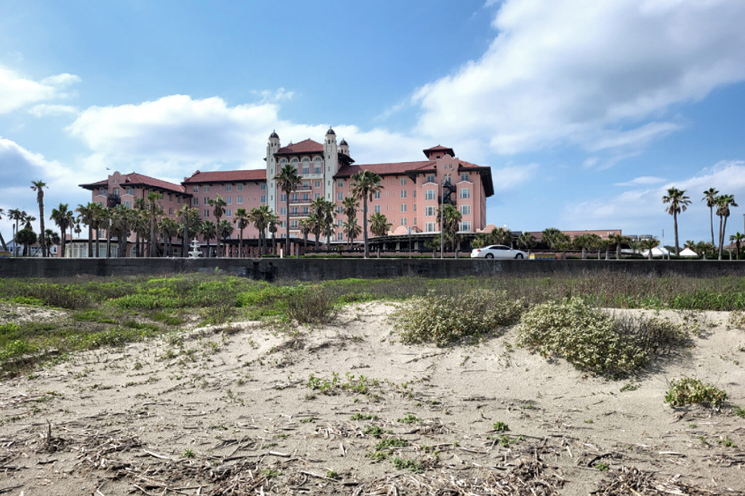
Like many coastal cities, Galveston (Texas, USA) faces increasing flood risk challenges. A Ring Barrier Plan, is proposed to protect the area against storm surges. The barrier design consists of several concrete walls and barriers and will be complemented with a rainwater drainage system. During a field visit and design workshop together with local stakeholders, we discussed spatial impacts and potential spatial optimization of the Ring Barrier Plan.
Anne Loes Nillesen has been appointed Professor at TU Delft
We’re very proud to share that our founder Anne Loes Nillesen has been appointed Professor of Urban Design at TU Delft Urbanism Department. She will be focusing on strengthening the connection between research and design, integral design methodologies and associated multidisciplinary work-forms, and linking design with societal challenges, amongst which, climate change.
Anne Loes will of course remain active as Founding Director for Defacto Urbanism.
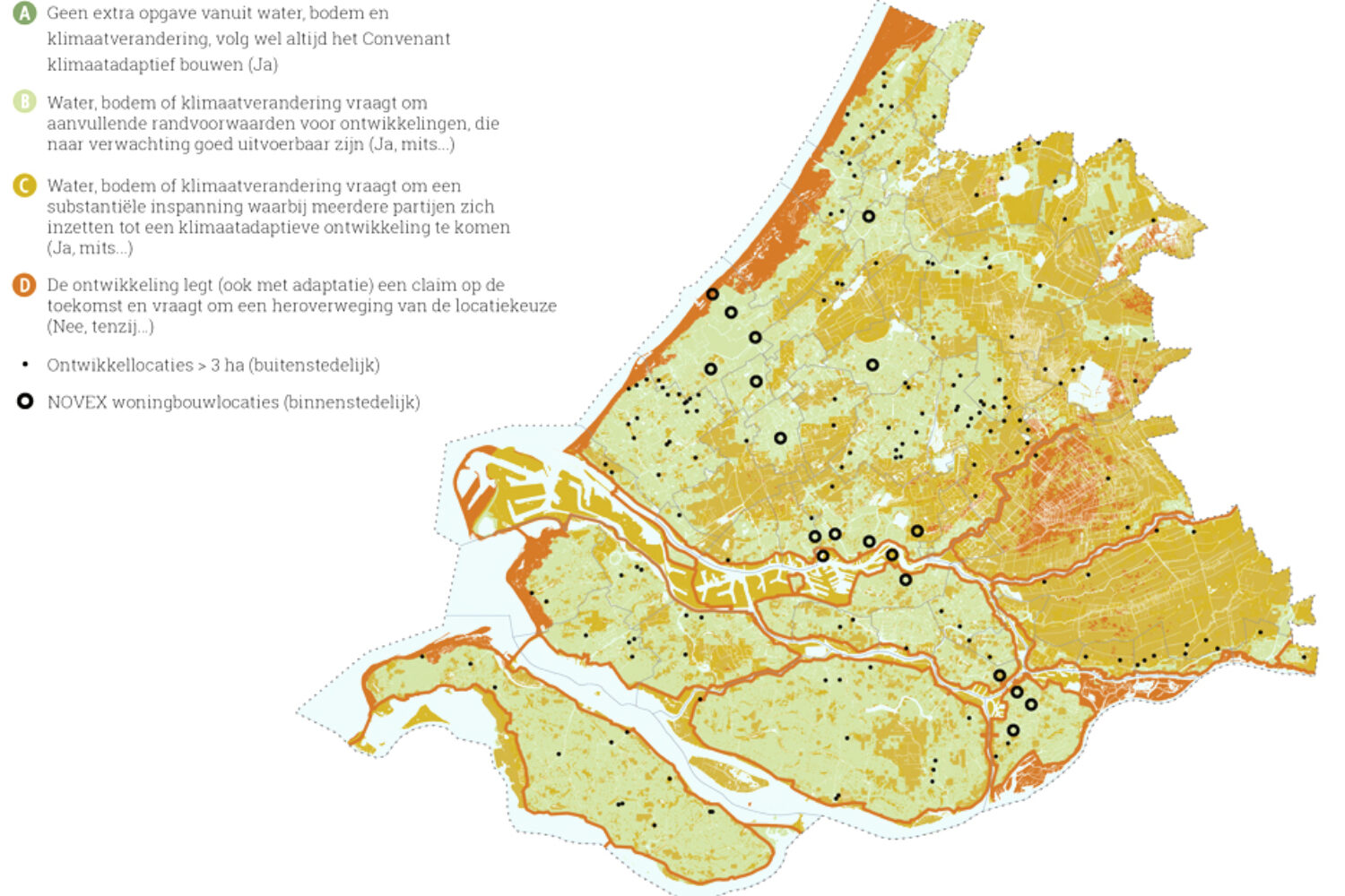
Climate Base Map South-Holland
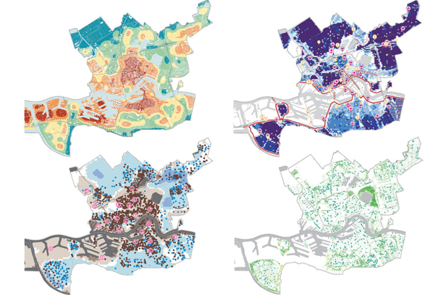
Defacto together with the Province of South Holland and the water boards, developed a ‘climate base map’ that provides insight in conditions for land use deriving from the water- and soil system and climate change, as well as guidelines for climate proof urbanization, agriculture and nature developments. This project results from the ‘Water and Soil as guiding principle’ policy letter (‘Kamerbrief Water en Bodem Sturend’), a call for action by the national government, to stop passing on climate responsibility and costs to future generations, different areas or from the private to the public sector.
The map series shows climate challenges until 2100 in relation to flood risk management, subsidence, rain water discharge, water availability, water quality and heat stress. During a series of workshops with experts we together elaborated the impact of climate change and indicated areas that on the long term will be (un)suitable for traditional land use functions. We indicated where land use functions are considered unsustainable and should be reconsidered (orange on the map), where a joint effort is required to transform land use in a climate proof way (yellow on the map) and where guidelines can secure climate proof development (green on the map).
Municipalities can use the developed ‘climate base map’ to direct housing development, nature development and policies and agriculture transition. The map indicates what development could best be located where and provides guidelines for climate proof development.
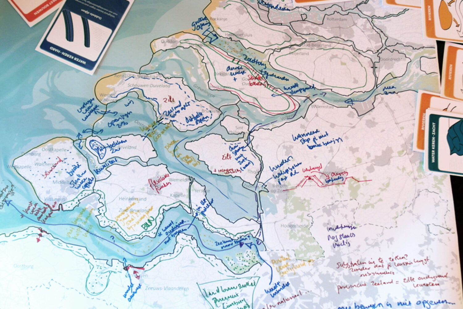
Kennisprogramma Zeespiegelstijging
70 years ago today the great flood took place and flooded large parts of the southwestern provinces of the Netherlands. After that, the Delta works were built to protect the South West Delta. While the area is still well protected from flooding, it is unsure how long these measures will be sufficient in the light of sea level rise.
As part of the national knowledge program on sea level rise (Kennisprogramma Zeespiegelstijging) we explore different long-term development directions and their spatial and functional implications to ensure a resilient delta area in the future.
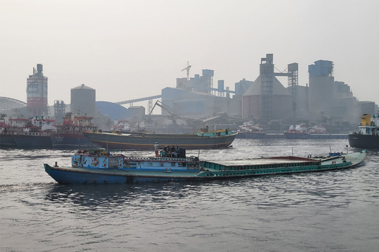
Dhaka Field Trip
The rivers around Dhaka are very diverse in their characteristics and face multiple complex challenges. As part of the umbrella investment program (a technical assistance to the GoB, commissioned by The World Bank) a boat trip was organized. During this field visit we discussed the current status and potential projects and investment for the rivers together with local authorities.
We look forward to further developing the prioritization strategy for investments to improve the river quality together with Royal HaskoningDHV, Delta Context B.V., The World Bank and the Government of Bangladesh.
Rotterdams WeerWoord 2030
The municipality of Rotterdam adopted the Rotterdams WeerWoord 2030. For this program we developed integral frameworks and perspectives for climate adaptation that can be applied by city makers. With this milestone, the programmatic approach Rotterdam WeerWoord enters a new phase of scaling up the implementation of climate adaptation city-wide.
For this project we developed climate analyses and perspective maps for different neighbourhoods and stakeholders, together with Nelen & Schuurmans.
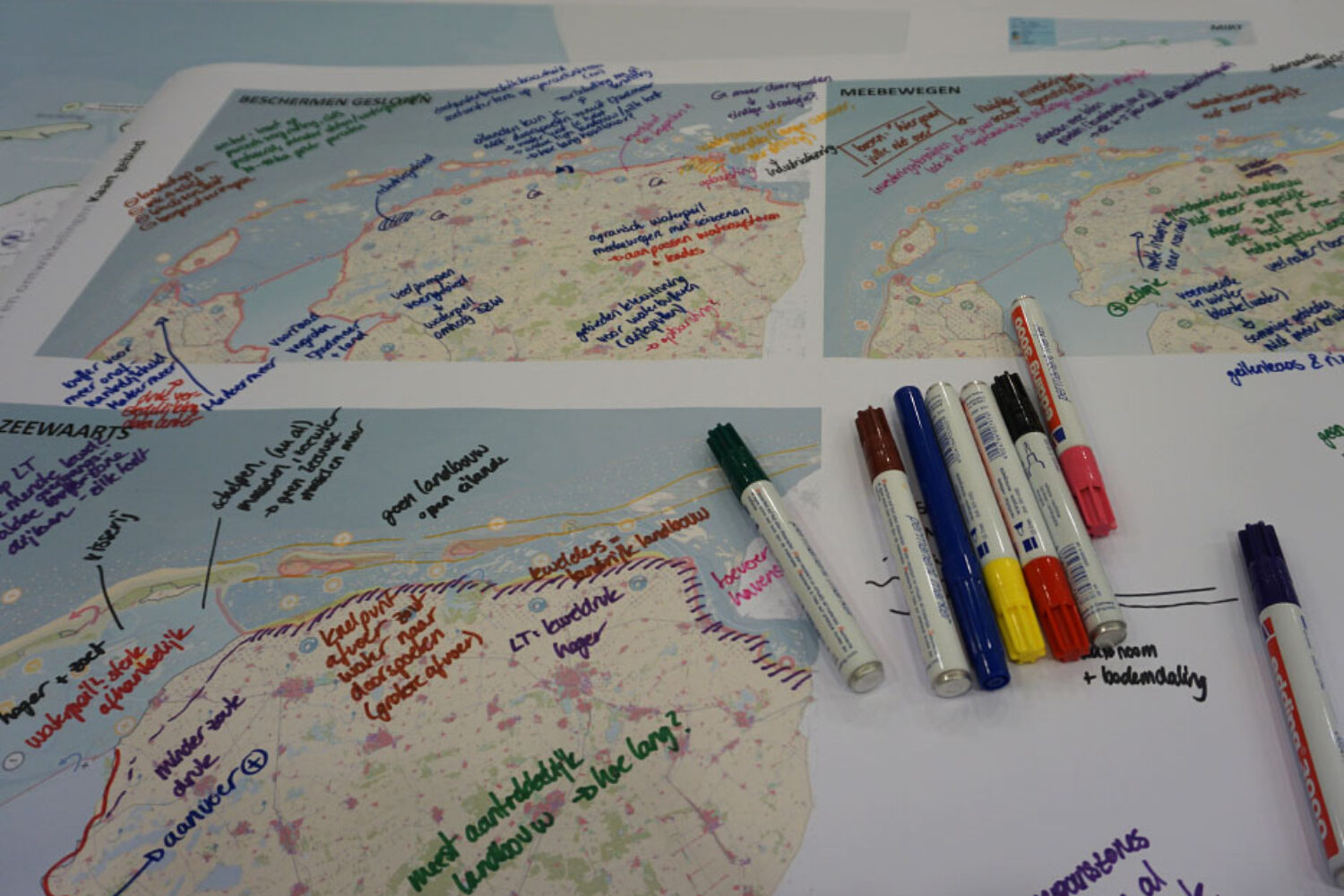
Workshop sea level rise Wadden Sea area
As part of the Netherlands sea level rise strategy development we organised a workshop series to explore long term perspectives for sea level rise. One of the regions we visited is the Wadden Sea. Together with local experts we explored the relation between land use and directions for sea level rise (protection, coastal advance, living with water). The island-identity and the ecological qualities of this UNESCO-area make this a unique location.
The workshop series is part of the national knowledge programme on sea level rise (Kennisprogramma Zeespiegelstijging spoor IV). The Delta program released a video that stresses the urgency to investigate and understand the system and the impact of future sea level rise. You can find the video here
Happy New Year 2023
The Defacto Urbanism team wishes all clients, colleagues and friends a Happy New Year!
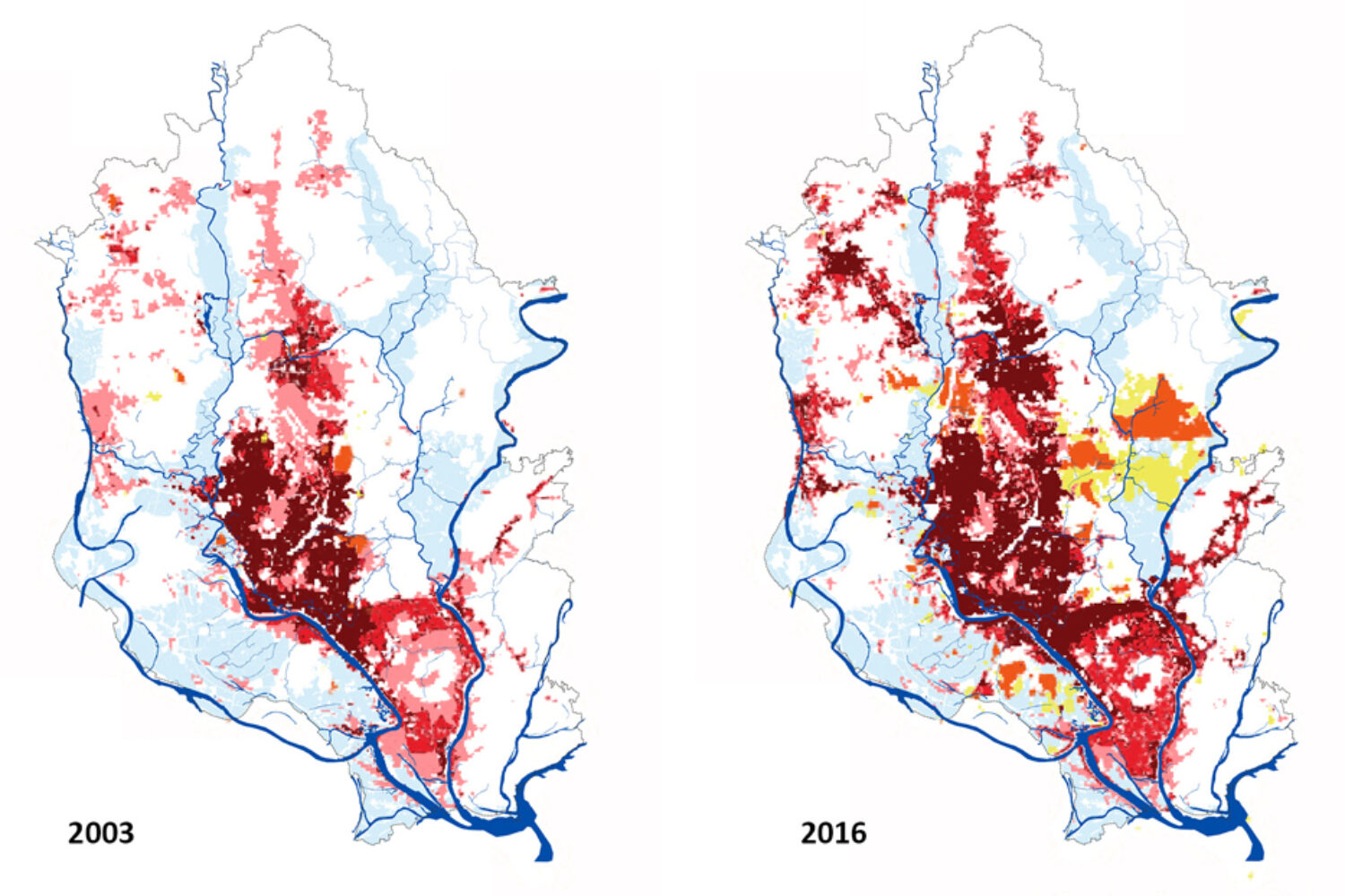
Bringing Dhaka rivers back to life
The quality of the five rivers around Dhaka have decreased drastically over the last decades due to unsustainable land use and heavy pollution. Together with Royal HaskoningDHV and the Government of Bangladesh we are working on an umbrella investment programme (UIP) commissioned by The World Bank. The aim is to improve and restore the quality of livelihood and economic development of the rivers around Bangladesh’s capital city by making strategic choices on investments.
You can read more about the project in the article The Daily Star
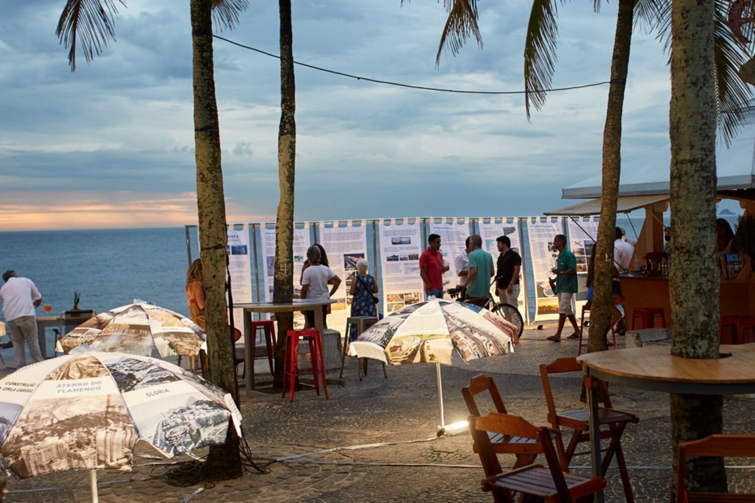
Exhibition in Rio de Janeiro
This year our works were on display in several exhibitions, including the “Costa Carioca: Paisagem em transformação” (Costa Carioca: a landscape in transition). The exhibition emphasized Nature Based Solutions and included different examples from a range of our projects, like ‘Water as Leverage – Khulna’, ‘Dutch Delta Programme Rijnmond-Drechtsteden’, ‘Sea Level Rise 2100’, ‘The Hague, City by the Sea’ and the ‘Houston Bay Barrier’, among others.
The exhibition was organised by Pedro Évora from Évora Arquitetura and Renee Nycolaas from Hogeschool Rotterdam with funding from the Dutch consulate in Brazil.