Utrecht, the Netherlands
Climate Basemap Utrecht
Climate impact analyses and base map for guiding spatial developments
The Utrecht waterpartners (Waterboards Amstel, Gooi en Vecht, Vallei en Veluwe en Rivierenland), water supply companies (Vitens, Oasen en Waternet), the Department of Waterways and Public Works, and the Province of Utrecht.
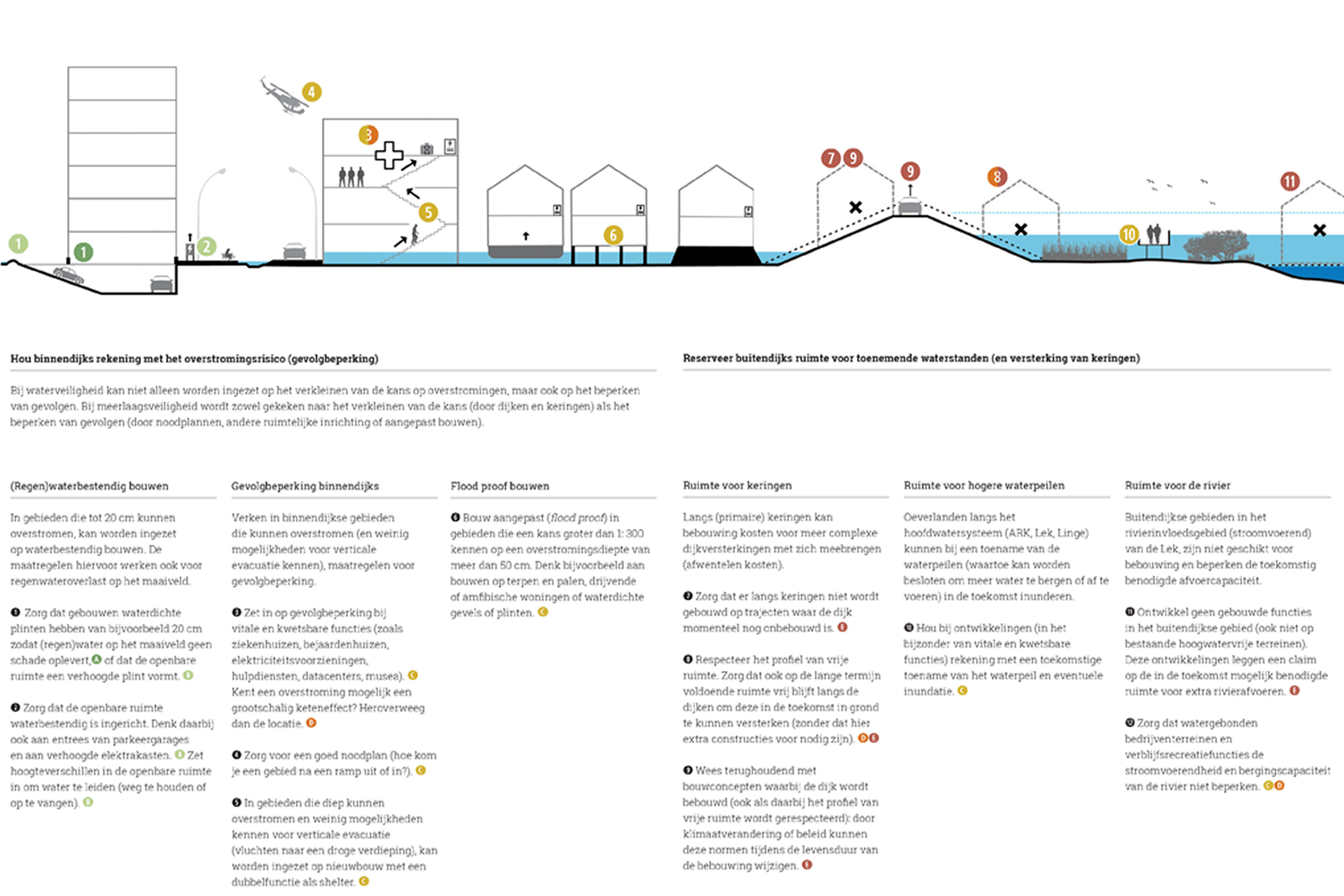
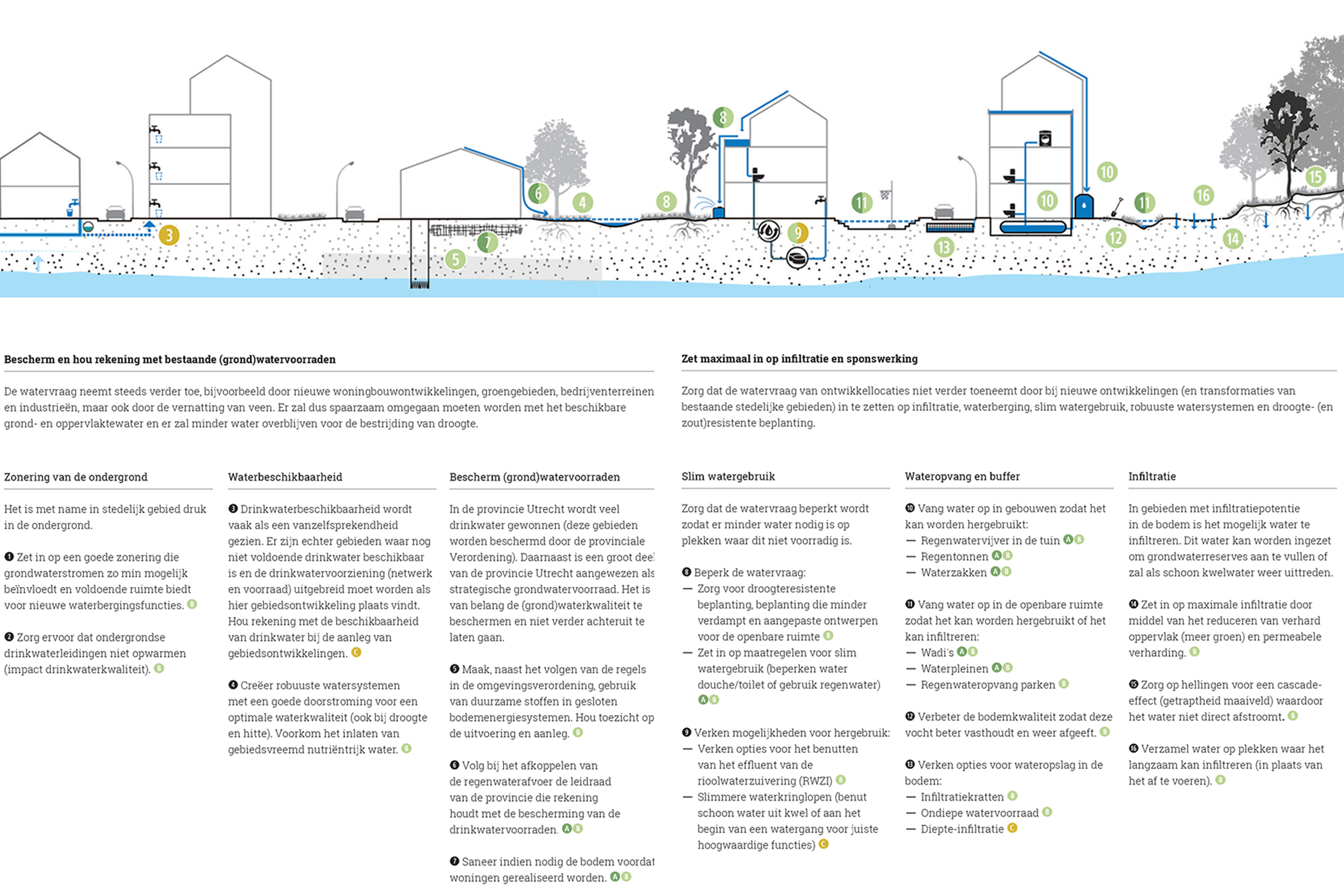
Climate change will impact the soil and water system, and with that future conditions for land use. Defacto together with the Utrecht waterboards and the Province of Utrecht, developed a suitability map for built developments. The map indicates conditions from the water and soil system that are relevant to address in development plans, and provides guidelines for climate proof urbanization.
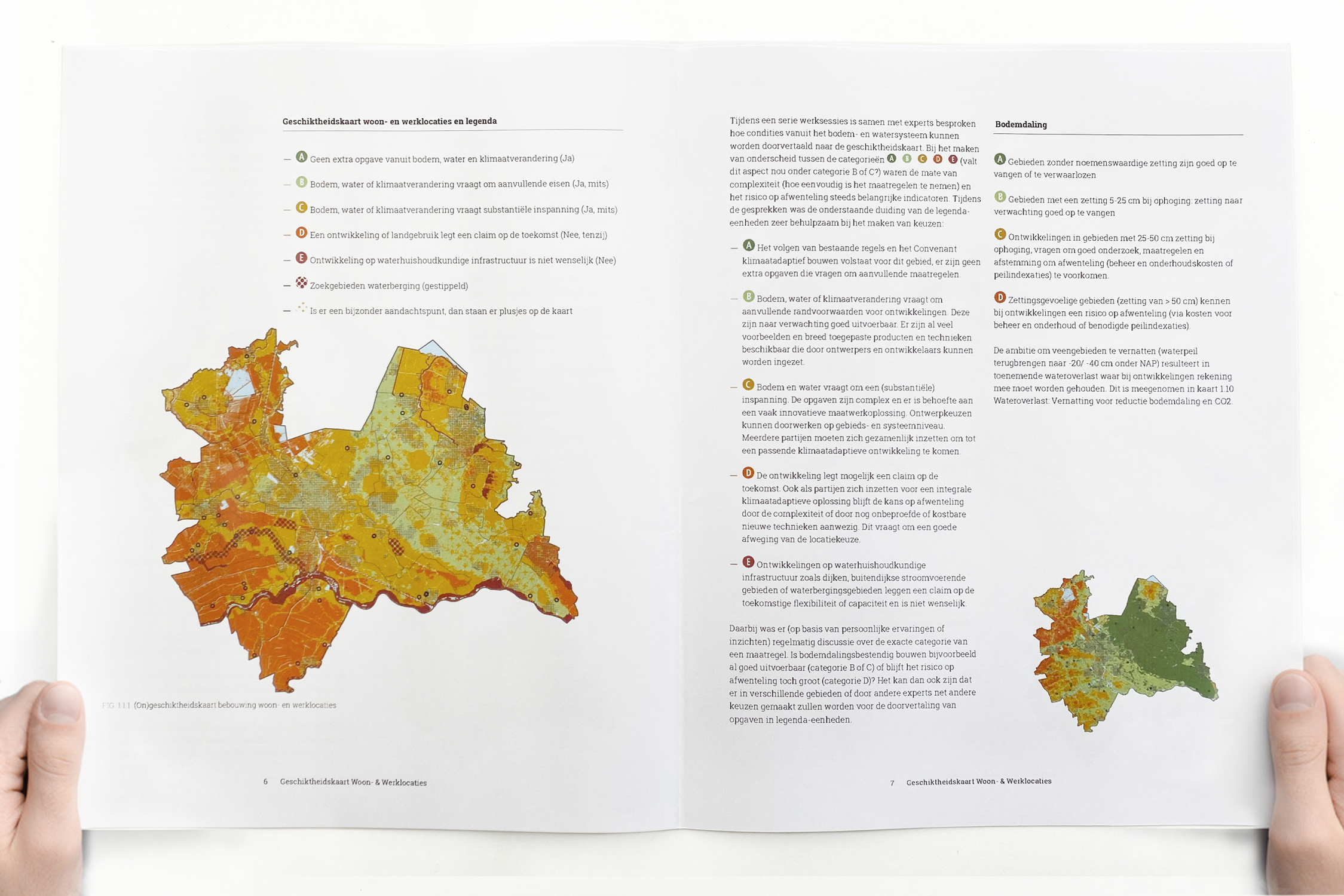
The map indicates where the natural conditions, can in the future result in additional adaptation cost. In line with the national spatial memorandum, the aim is prevent passing off these adaptation cost to future generations. This can be achieved by anticipating on future adaptations required during the life span of developments in the design phase of project. The map indicates for which areas developing in a climate proof way results in additional effort and cost. With that it supports in selecting the most suitable locations for development from a climate perspective.
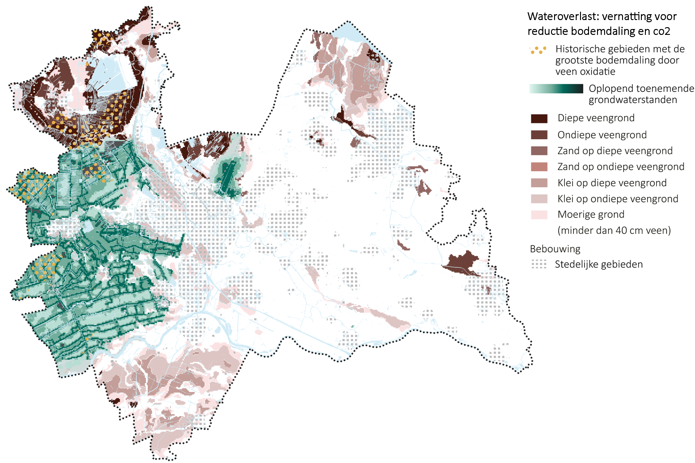
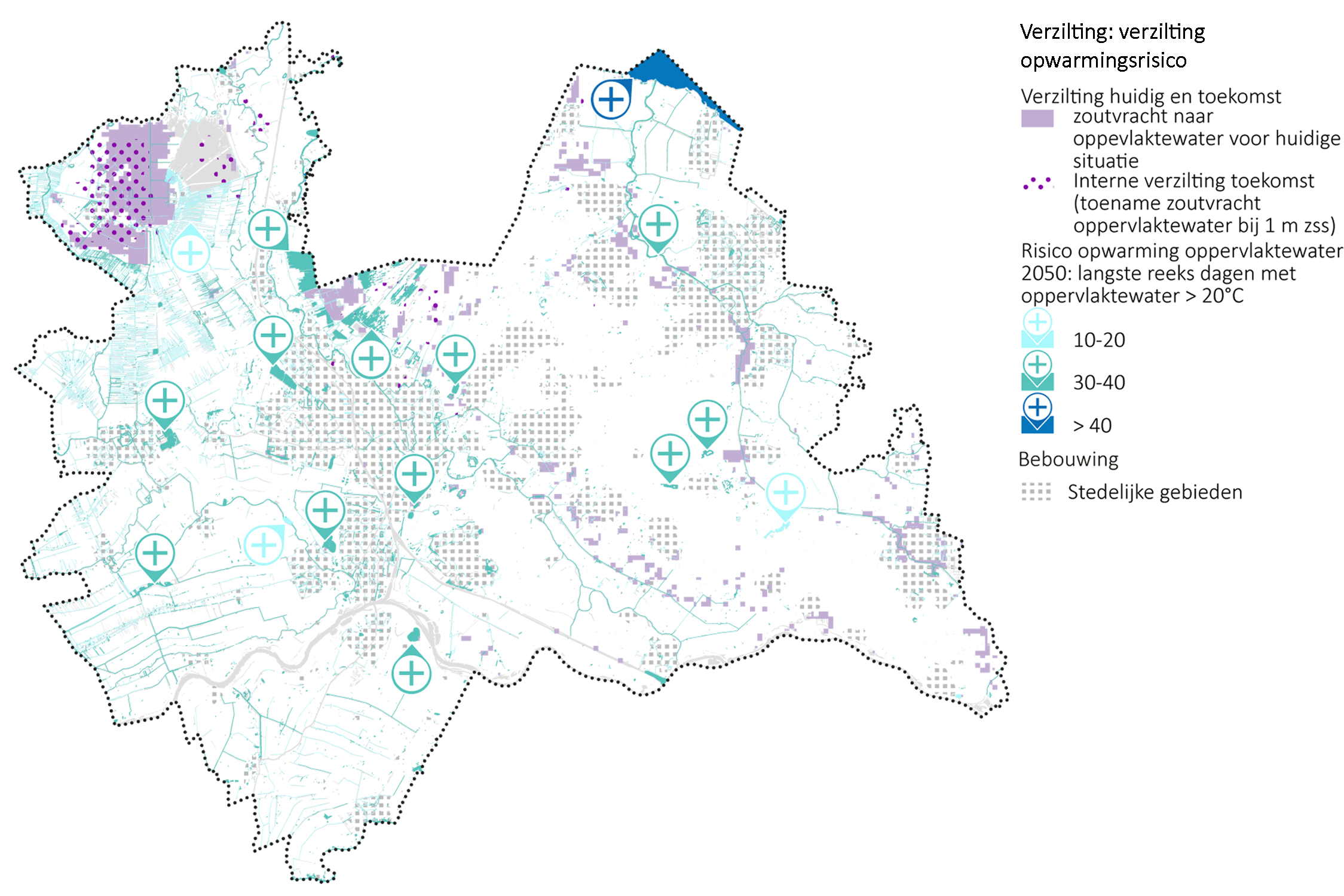
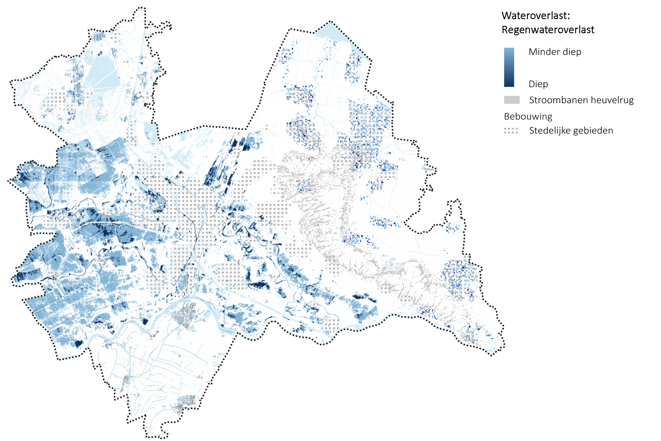
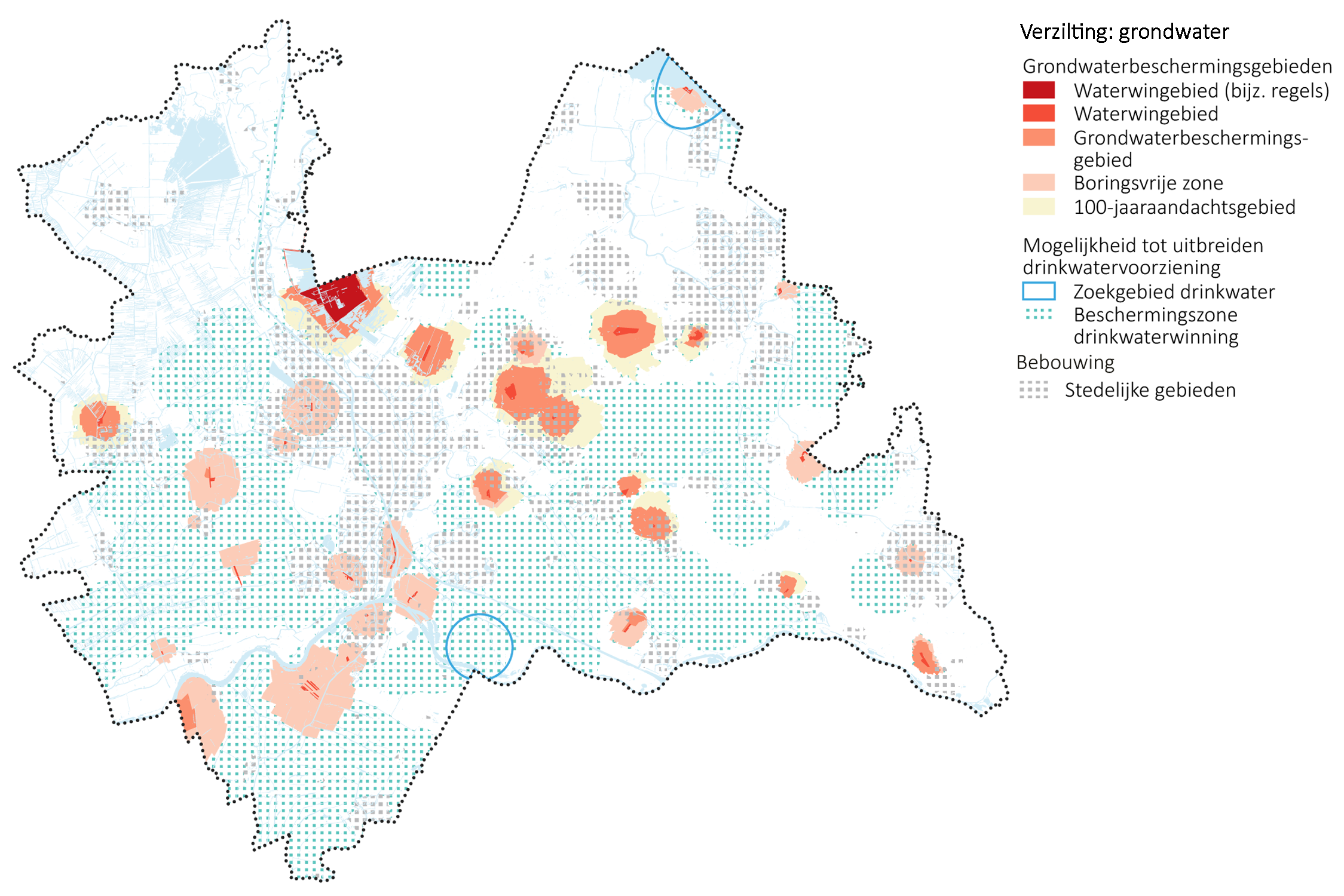
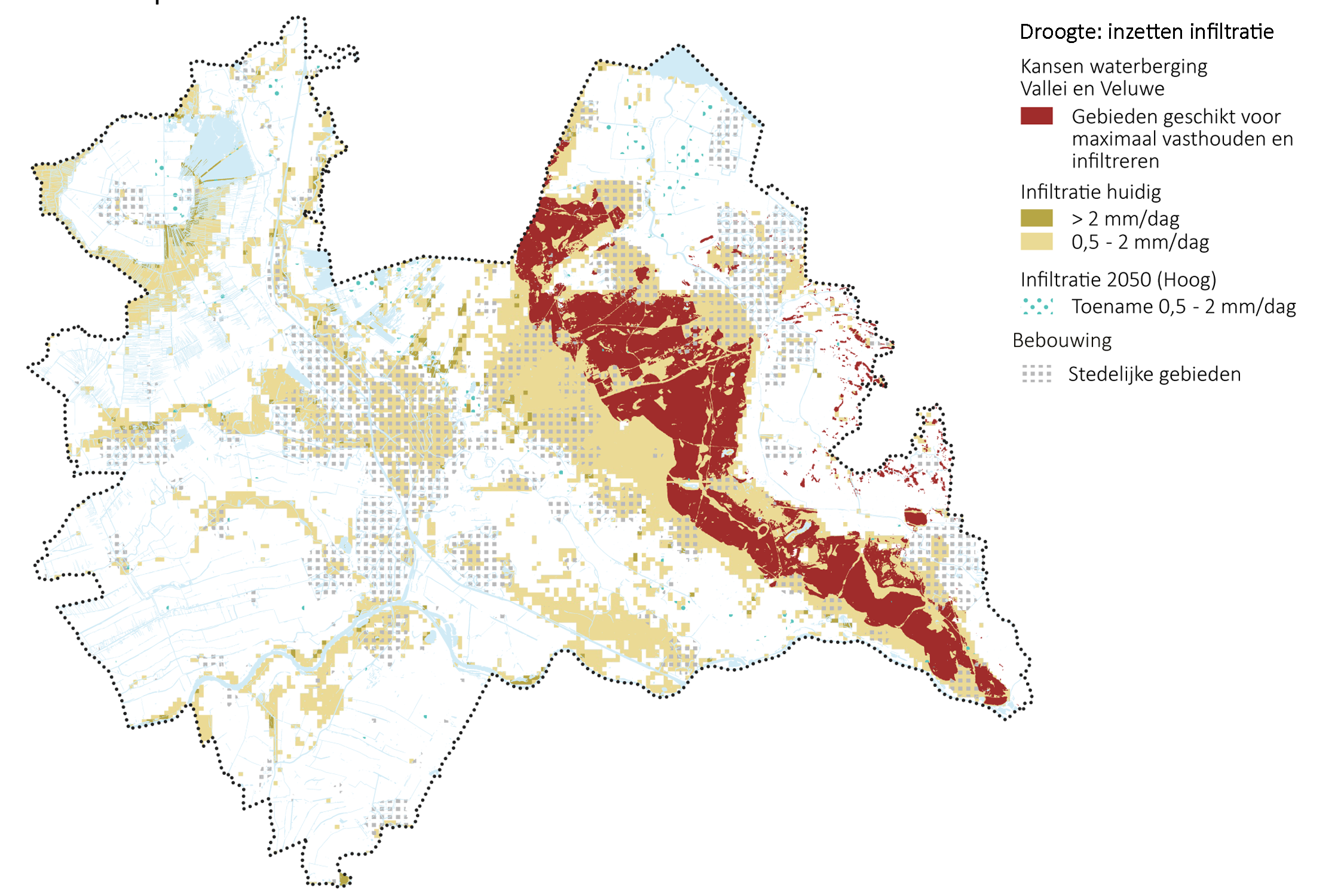
The base of the suitability maps consists of a series of thematic base maps and future projections related to amongst others subsidence, flood risk management, water availability and -quality (and will in time continuously be updated once new insights and scenario’s become available). The suitability map uses color coding to communicate the suitability of a location for developments. For unsuitable areas (orange on the map) alternative locations should be explored. Area’s that result in challenges (yellow on the map) require a joint effort to develop in a climate proof way. Other area’s have good natural conditions for development (green on the map), though within this low-lying part of the Netherlands these are in minority.
The map will be used as a base to re-introduce suitability conditions from the water system and subsoil as a relevant factor in spatial planning.
Client: Hoogheemraadschap de Stichtse Rijnlanden (HDSR)
In cooperation with: The Utrecht waterpartners (Waterboards Amstel, Gooi en Vecht, Vallei en Veluwe en Rivierenland), water supply companies (Vitens, Oasen en Waternet), the Department of Waterways and Public Works, and the Province of Utrecht.