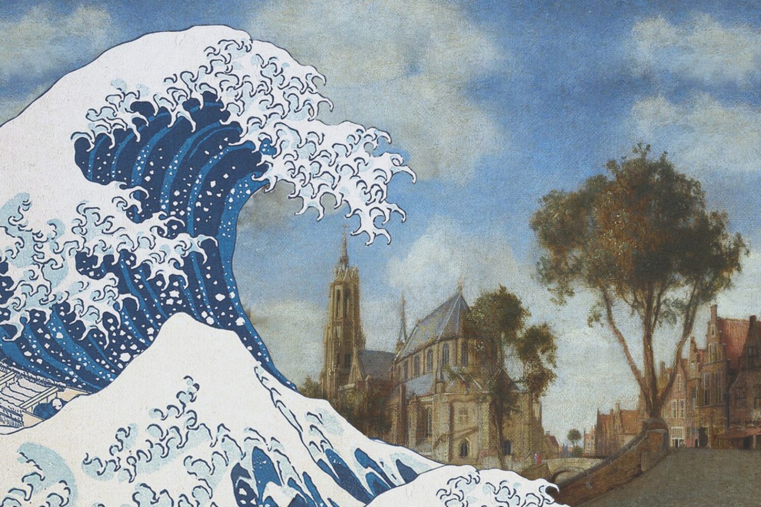
Anne Loes Nillesen is the guest of episode five of ‘De Fijne Stad‘, a podcast series that offers inspiring perspectives on climate-proof and future-proof cities in the Netherlands. She emphasizes the importance of measures for sufficient space for water and promoting healthy soils that can retain and release water during drought.
Stadmakerscongres 2024
Sluit je aan bij onze werktafel tijdens het Stadmakerscongres op vrijdag 15 november? We verkennen tijdens deze sessie het buitendijkse deel van Rotterdam met als startpunt onze klimaatadaptatiestrategie voor Katendrecht.
In deze sessie van 10:30 – 12:00 zullen we kijken naar de implicaties van overstromingsrisico’s op zowel de bestaande stad als nieuwe ontwikkelingen. Ook is er ruimte om uit te zoomen en de mogelijkheden voor andere buitendijkse gebieden te bespreken.
Meer info of een ticket reserveren doe je hier: https://lnkd.in/eFYegwg5
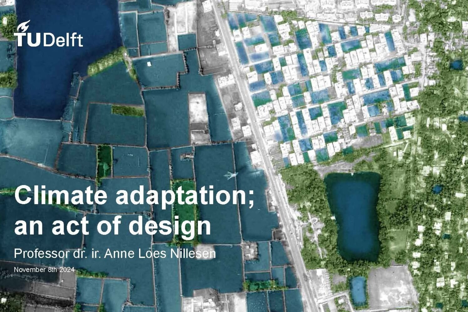
Anne Loes Nillesen will give her inaugural speech: ”Climate Adaptation; an Act of Design”
On the 8th of November 15:00 at TU Delft, Anne Loes Nillesen will give her inaugural speech, with the title ‘Climate Adaptation; an Act of Design’. She will show national and international examples of design research in which options for climate adaptation are explored and visualized at all scales, from Delta system to neighborhood level. This also reveals important bottlenecks and strategic choices; how can you as a designer contribute to a future-proof design and adaptation of cities and regions?
You are welcome to join the lecture and drinks from 15:00 in the Aula TU Delft; you can register through this link: https://lnkd.in/eSfw456y
Bestuurlijke Netwerkdag Water (Metropoolregio Amsterdam)
Drinkwaterbeschikbaarheid blijkt (zeker als het systeem moet worden uitgebreid) een sterke ruimtelijke component te hebben, en integraal te moeten worden meegenomen in de ruimtelijke strategievorming. Tijdens de Bestuurlijke Netwerkdag Water (Metropoolregio Amsterdam) heeft Anne Loes Nillesen een presentatie gegeven over het ‘Keuzevraagstuk drinkwater’ in dit gebied van PWN Vitens Waternet. Het was prachtig om op locatie te zien hoe de watervoorraad in de ‘Amsterdamse Waterleidingduinen’ (eindelijk) weer eens goed aangevuld is, en erg interessant te horen dat dit juist tot onbegrip en klachten in de omgeving leidt (natte kelders, onbegaanbare recreatiepaden).
Waterbouwdag 2024
Our water infrastructure (waterways, quay walls and dikes) needs to be more adaptive and future-proof, which requires space. Multiple experts met together at Waterbouwdag 2024: Space for water engineering! to share their knowledge about the future of ‘Waterbouw Nederland’.
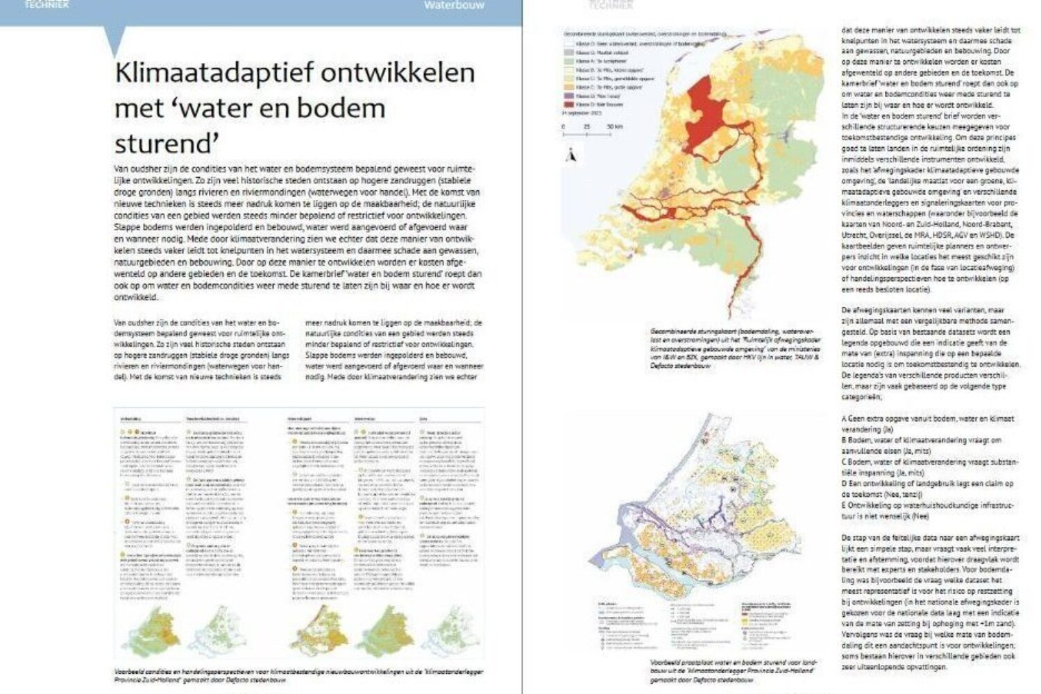
Anne Loes Nillesen was one of the lecturers and she presented several examples for spatial development with ‘water and soil steering’. In the accompanying article in the hydraulic engineering special of the magazine Civil Engineering, she discusses the method for visualizing the ‘suitability of water and soil for developments’ that we have further developed in recent years (together with the national government, various provinces and water boards and engineering firms).
You can check out the article here https://lnkd.in/e4c82aEr
Peer-to-Peer Exchange for Latin American cities
A more comprehensive perspective on urban climate resilience is a top priority for urban urgencies such as flood mitigation.
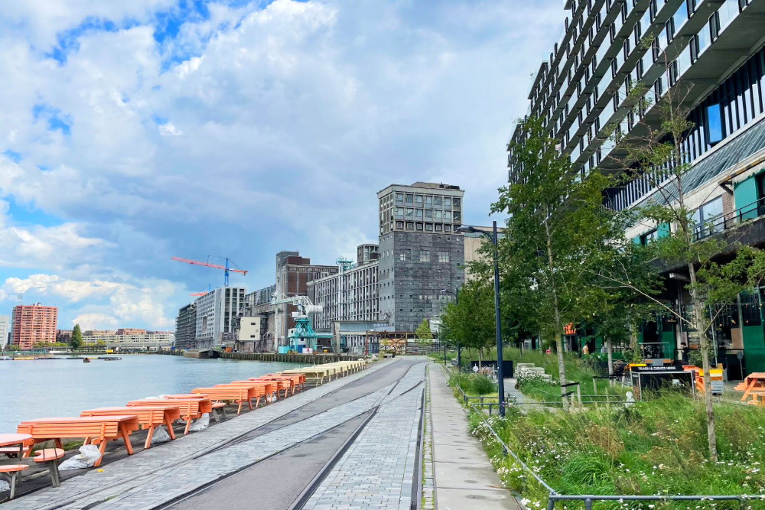
Facilitated by UrbanShift and World Resources Institute at the Floating Office in Rotterdam, Anne Loes Nillesen was one of the presenters at Peer-to-Peer Exchange for Latin American cities, together with Nanco Dolman, Arnoud Molenaar and Johan Verlinde. Supported by Gemeente Rotterdam and Global Center on Adaptation, the dialogue among representatives brought integrative and thoughtful approaches for enhancing resilience and building healthier, more connected communities.
Research by design on long term perspectives for the Flemish-Dutch Delta
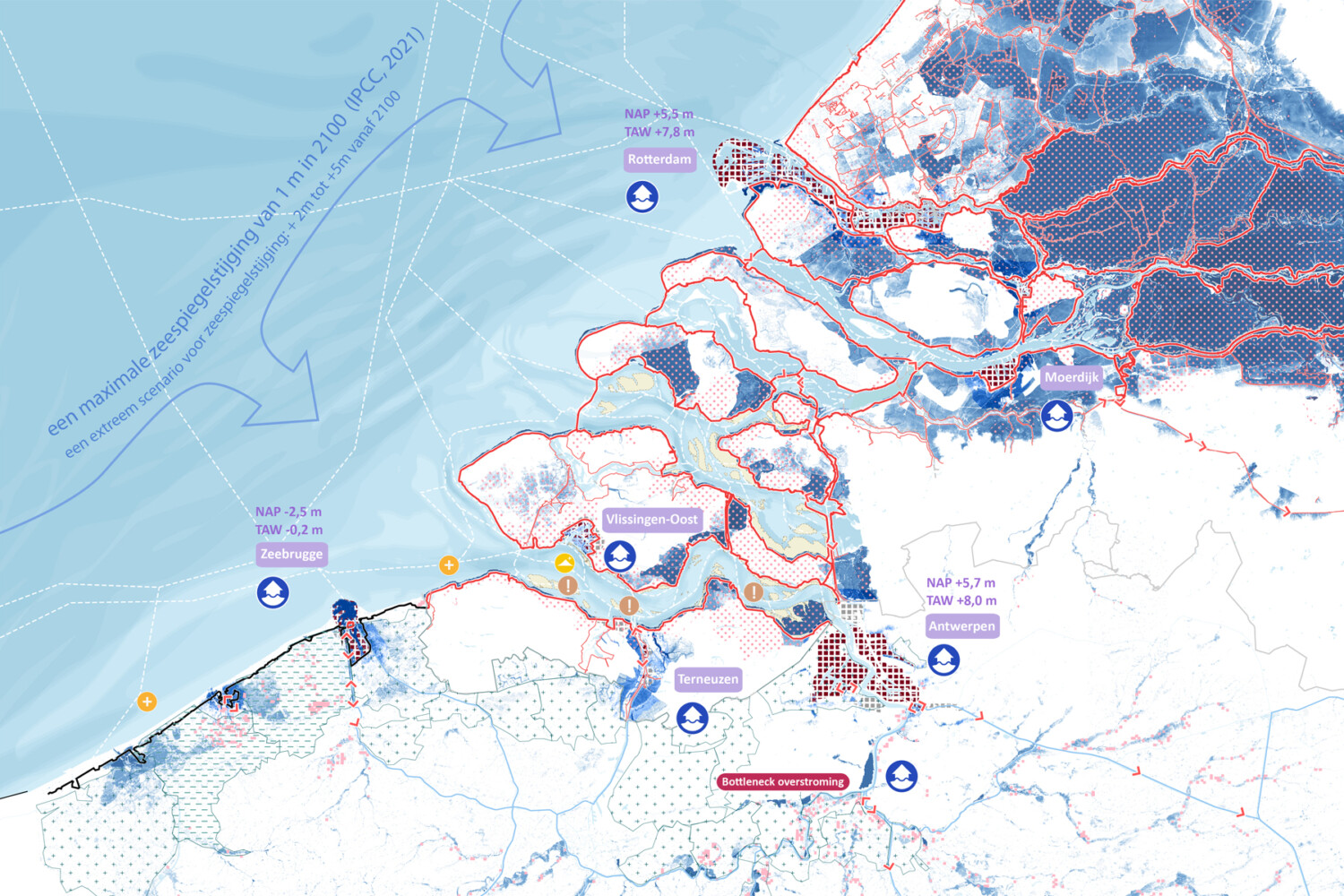
We presented our research by design on long term perspectives for the Flemish-Dutch Delta and its port-, water- and energy system to the steering committee of Flemish-Dutch Delta (stuurgroep Vlaams-Nederlandse Delta).
The Delta, formed by the confluence of the Rhine, Meuse and Scheldt rivers, fulfils an essential economic role as a logistical gateway between the North Sea and Northwest Europe. Its location makes the delta especially vulnerable to climate change impacts, such as sea level rise, salinisation and extreme weather events. It is not possible to maintain the current situation.
The Flemish-Dutch Delta will undergo profound changes in the coming decades. We explored future perspectives for the Rotterdam -Antwerp (port)area. Together with Cluster Landscape (BE) and Erasmus UPT we explored which fundamental choices need to be made now to make the Flemish-Dutch Delta future-proof. The study highlights that adjustments in operations, layout and land use are necessary and require fundamental decisions now.
For this study we collaborated with the Vlaams-Nederlandse Delta Netwerk en Team Vlaamsbouwmeester, assigned by the College van Rijksbouwmeester & Rijksadviseurs.
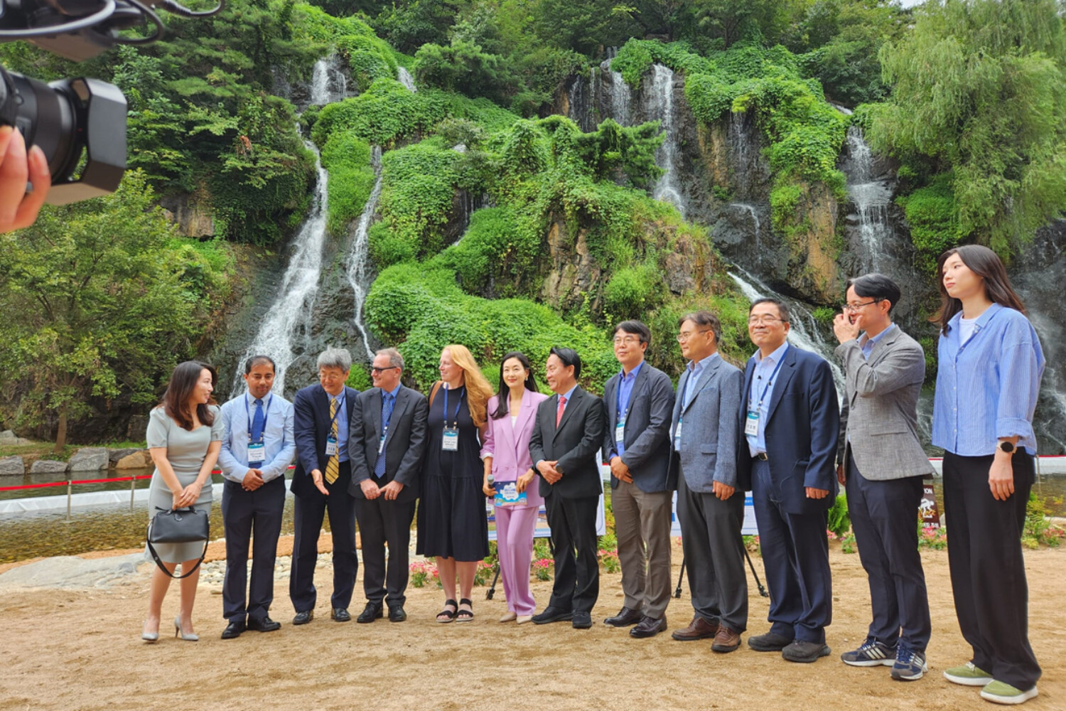
Water Seoul 2024 International Conference
Anne Loes Nillesen was a speaker at the WaterSeoul2024InternationalConference. Experts from varied countries presented on topics such as flood risk management, coastal protection, nature-based solutions and urban development strategies. She presented an overview on “Climate proof waterfronts’’ and highlighted possible future directions based in best practice examples for integrated flood mitigation, climate adaptation and urban revitalization.
#Seoul urbandesign urbanplanning landscapedesign climateadaptation waterfront coastalprotection
Van Leeuwenhoeklezing: Delft aan zee? Hoe Nederland verandert door klimaatverandering
October 6, 2024, 11:00 – 12:00, Theater De Veste, Theatercafé
Anne Loes Nillisen, Gastheer: Rob Mudde
Registreren via Theater de Veste
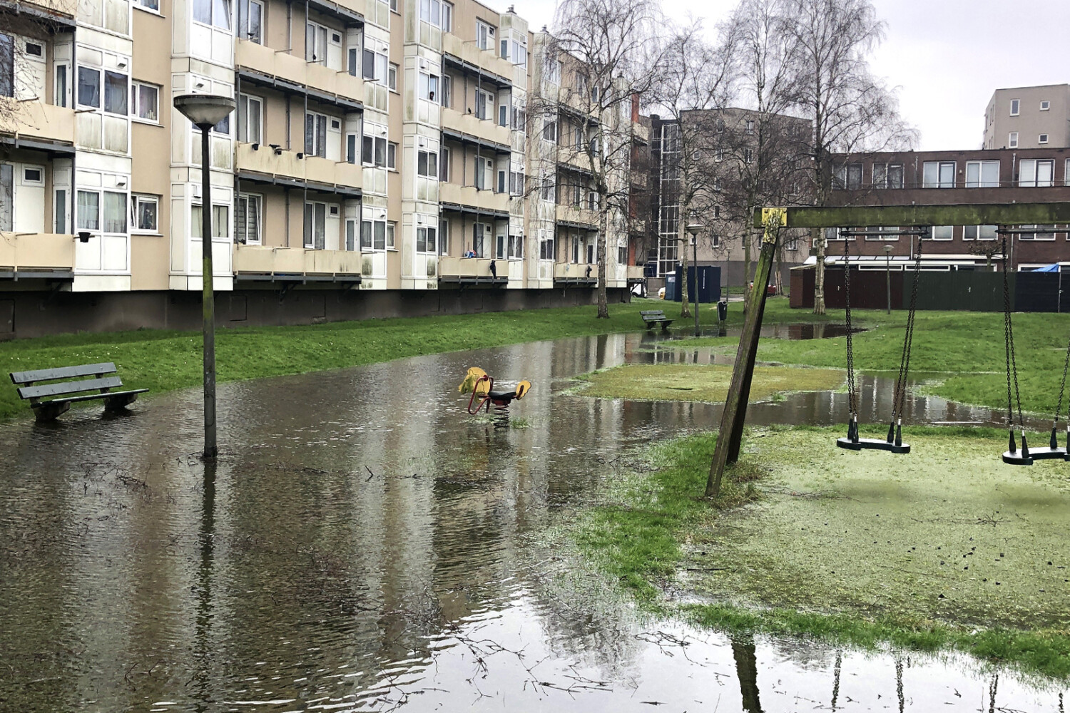
Dat het klimaat verandert is inmiddels bekend, maar wist u dat Nederland er daardoor heel anders uit zal gaan zien? Door de toenemende zeespiegelstijging, hogere temperaturen, steeds extremere buien en langere periode van droogte zullen we onze steden en landschappen zich moeten aanpassen, of we dat nou willen of niet.
Niet overal zal het meer veilig zijn om te wonen, rivieren (en havens) zullen afgesloten worden van de zee, niet alle landbouwgewassen kunnen nog worden verbouwd en de steeds voor hogere dijken en piekbuien zullen veel ruimte vragen. Deze veranderingen zijn ingrijpender dan vaak wordt vermoed, maar kunnen ook grote kansen bieden voor inspirerende nieuwe toekomstbeelden.
Tijdens de lezing neemt Anne Loes Nillesen (Defacto en Professor Urban Design) u mee in de uitdagingen en moeilijke keuzen waar we de komende periode voor komen te staan, maar ook in de aansprekende nieuwe toekomstbeelden die daarmee in beeld komen.
De Koele Kaart van Rotterdam
De klimaatverandering brengt naast veel wateroverlast ook hitte en dat heeft enorme implicaties voor de gebouwde omgeving. Binnen Cooling Rotterdam laat Anne Loes Nillesen zien dat er veel verschillende ingrepen mogelijk én nodig zijn. “Architecten ontwerpen hier niet met hitte als uitgangspunt.”
Hier kunt u meer lezen over het interview.